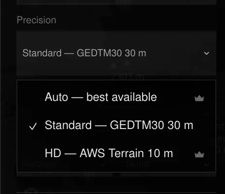
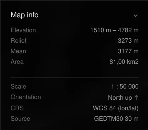
Every map — Lines or Points — is traced from a digital elevation model (DEM): a grid of ground heights. The source is picked in the Precision menu of the Settings panel, and the one that actually served your zone is shown in the Map info panel after each generate.
Sources
| Source | Resolution | Coverage | Plan |
|---|---|---|---|
| GEDTM30 | ~30 m | Worldwide | Free (Standard) |
| AWS Terrain GeoTIFF | ~10 m | Worldwide | Pro (HD) |
| IGN RGE ALTI | 5 m | Metropolitan France | Pro (HD) |
| USGS 3DEP | 10 m | United States | Pro (HD) |
| IGN España MDT | 5 m | Spain | Pro (HD) |
| Your own GeoTIFF | Yours | Your file | Pro |
GEDTM30 is a bare-earth model: it represents the ground under the forest canopy rather than the treetops, which gives cleaner contours in wooded terrain.
Precision menu
- Standard — GEDTM30 30 m (free): the default everywhere.
- HD (Pro): the best national model covering your zone, or the worldwide 10 m GeoTIFF where there is none. The menu shows which one your zone will get.
- Auto — best available (Pro): picks the finest source for each zone automatically.
A zone that crosses a border between two national models falls back to the worldwide source, so a map is never stitched from two datasets.
Upload your own DEM
Pro accounts can trace their own terrain: pick DEM upload in the search
mode menu and choose a GeoTIFF (.tif / .tiff, georeferenced, up to 200 MB).
The map moves to the file’s footprint; draw a zone inside it and generate as
usual. Your raster never leaves the server — only the traced output does.
Attribution
National models are open data published under their own licences. TopoLines writes the source and its required credit into the metadata of every export, so you can cite it where the map is used.
Last updated 28 September 2026