France is one of the best-covered countries in the world for open terrain data. Everything below is published by IGN (the national mapping agency) under the Etalab Open Licence 2.0, which allows commercial use with attribution, unless a row says otherwise.
At a glance
| Dataset | Publisher | Type | Grid | Heights | Projection | Licence |
|---|---|---|---|---|---|---|
| MNT LiDAR HD | IGN | Terrain (DTM), lidar | 0.5 m | NGF-IGN69 (mainland) | Lambert-93 (EPSG:2154) | Etalab 2.0 |
| MNS / MNH LiDAR HD | IGN | Surface (DSM) and canopy height | 0.5 m | NGF-IGN69 (mainland) | Lambert-93 | Etalab 2.0 |
| RGE ALTI® | IGN | Terrain (DTM), lidar + image correlation + radar | 1 m and 5 m | NGF-IGN69 (mainland), IGN78 (Corsica) | Lambert-93 (mainland) | Etalab 2.0 |
| BD ALTI® | IGN | Terrain (DTM), resampled from RGE ALTI | 25, 75 and 250 m | NGF-IGN69 (mainland) | Lambert-93 | Etalab 2.0 |
| Copernicus GLO-30 | ESA / Airbus | Surface (DSM), radar | ~30 m | EGM2008 | WGS84 | Copernicus licence |
| GEDTM30 | OpenGeoHub | Terrain (DTM), ensemble | ~30 m | See global models | WGS84 | CC BY 4.0 |
Overseas departments use local UTM projections and their own height systems. Read the metadata of the tile you download rather than assuming Lambert-93.
MNT LiDAR HD: the new reference
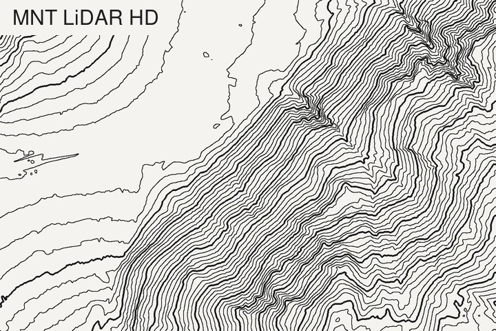
The LiDAR HD programme is flying the whole of mainland France and the overseas regions (except French Guiana) at a density of at least 10 pulses per m² (5 above 3,200 m). The classified point clouds are turned into three rasters at 50 cm:
- MNT: bare-earth terrain. This is the one to contour.
- MNS: the surface, with buildings and tree tops.
- MNH: the difference between the two, i.e. the height of what stands on the ground.
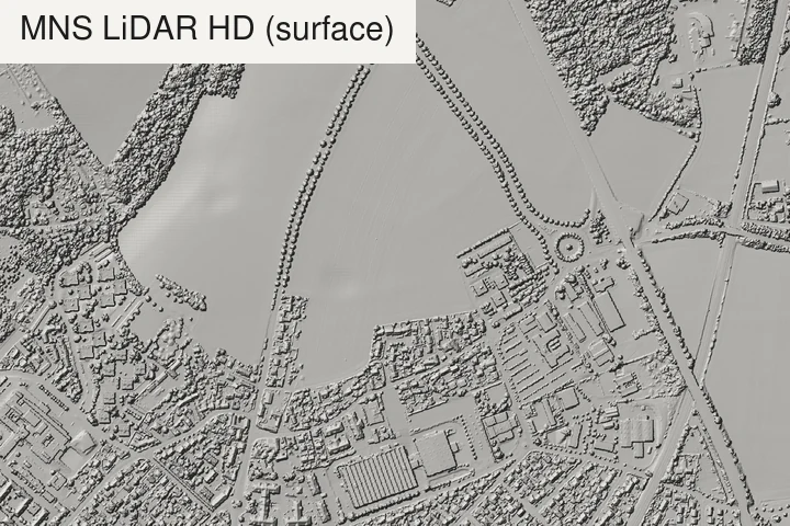
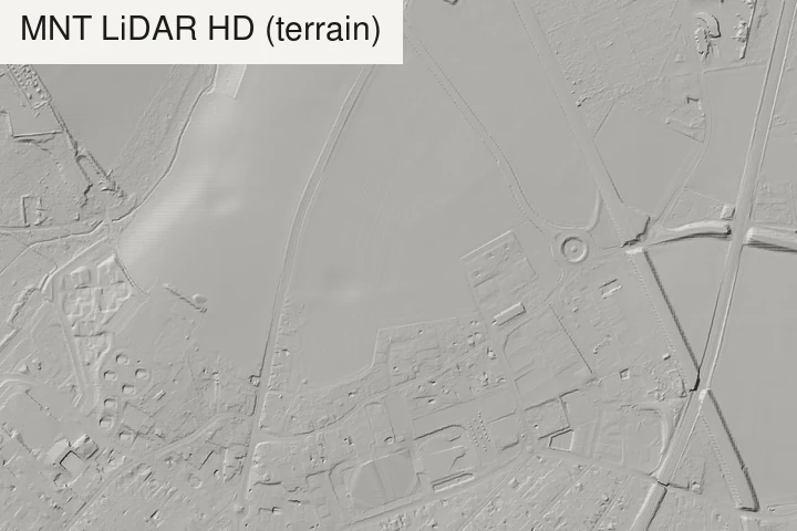
The tiles are 1 × 1 km GeoTIFFs. IGN’s target is full coverage by the end of 2026, but publication is still catching up: on 6 September 2026 the published classified point cloud covered 78% of the area of French communes, according to a coverage-by-commune dataset on data.gouv.fr. IGN publishes the classified cloud one to two years after the flight, and the rasters follow the point clouds. Check the live availability map for your area before planning around 50 cm data. A 5 m version of the MNT is announced but not yet published.
Traps. Areas where aerial capture is restricted (military and sensitive sites, known as ZICAD) are left as NoData. Tile edges can also carry NoData that you’ll want to interpolate before contouring, otherwise every tile boundary draws a fake cliff.
Download. From the cartes.gouv.fr catalogue (search “MNT LiDAR HD”) or from its data.gouv.fr page, which also lists the WMS and WMTS services.
RGE ALTI: the complete 1 m model
RGE ALTI covers mainland France, Corsica and the overseas departments (French Guiana only in part) at 1 m, with a resampled 5 m version, and is designed for scales from 1:3,000 to 1:20,000. IGN stopped updating it in 2024, pending a new reference built from LiDAR HD acquisitions (IGN). Until then, it is still the only model that covers the whole country at 1 m. Like LiDAR HD, it leaves ZICAD areas as NoData.
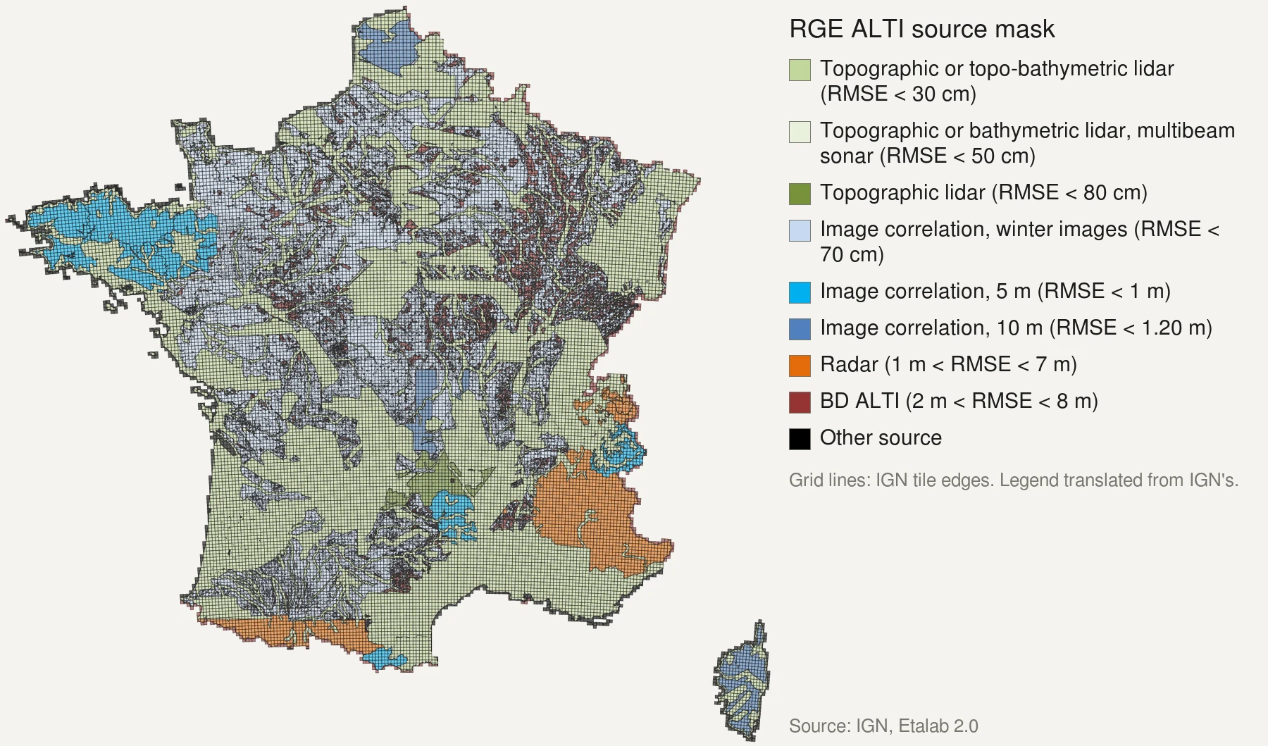
It is a patchwork of sources, and its accuracy depends on which one covers your area. The figures below are root-mean-square errors from IGN’s content specification (version 2.0, September 2018):
- Lidar in flood-prone, coastal and large forest areas: 0.2 to 0.5 m.
- Aerial image correlation on the rest of the territory: 0.5 to 0.7 m. Where woods hid the ground over large areas, gaps were filled with the old BD ALTI, at 2 to 8 m.
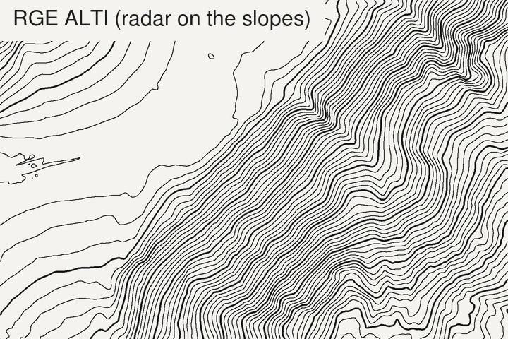
- Radar over the high mountains: around 7 m on steep slopes. IGN notes that this radar model sits below the real ground on summits, and does not recommend it for high-precision work.
The 2018 specification lists the Alps, the Pyrenees, the Cévennes and Corsica as radar areas. IGN’s current source mask, below (checked on 5 November 2026), only shows radar in the Alps (most of the southern Alps) and the Pyrenees: Corsica and the Cévennes are now covered by lidar and image correlation. When the two disagree, trust the mask for your area.
So a 1 m grid does not mean 1 m detail everywhere. In the high mountains, RGE ALTI is smoother than its grid suggests, and LiDAR HD, where published, is a real step up.
Download. From cartes.gouv.fr (search “RGE ALTI”), by department, as 1000 × 1000-node ASCII grid tiles, or read on the fly through the Géoplateforme WMS/WCS (our field notes on reading it over HTTP show how).
BD ALTI: only for the big picture
BD ALTI is published at 25, 75 and 250 m, for scales from 1:70,000 to 1:700,000. Since version 2.0 (2014) it is no longer built from digitised contour lines but resampled from RGE ALTI (IGN), so it carries the same sources, only coarser. It is handy for a whole-region overview where 1 m tiles would be gigabytes, but for anything at the scale of a valley or a site, use RGE ALTI or LiDAR HD.
Traps specific to France
- Altitude, not ellipsoidal height. IGN heights are NGF-IGN69 altitudes (normal heights, tied to the Marseille tide gauge). GPS gives ellipsoidal heights, which are higher by about 44 m around Paris and Lille, 51 m at Brest and 53–54 m in the Alps, according to IGN’s RAF20 conversion grid for the mainland. Mixing the two makes your GPS track float or dig into the terrain. QGIS and PROJ apply RAF20 when you pick the right vertical CRS.
- Corsica uses IGN78, not IGN69. Keep that in mind when you join datasets across the sea.
- Lambert-93 is metric and conformal, ideal for contours. Don’t contour in WGS84 degrees: intervals and smoothing will be distorted in latitude.
- MNS ≠ MNT. The LiDAR HD MNS draws every building and hedge as a contour. If your lines look like a city map, you picked the surface model.
What TopoLines uses in France
The free tier traces from GEDTM30 (30 m). HD exports read RGE ALTI from IGN at the finest grid your zone allows: 1 m for small zones, 2 m or 5 m for larger ones (automatic precision). The source that served your zone is shown in Map info and credited in every export. Full list in the datasets docs.
If you need the full 50 cm LiDAR HD resolution, download it from IGN and contour it in QGIS with Raster › Extraction › Contour (GDAL), or upload the GeoTIFF to TopoLines (Pro).
References
- IGN (2026). MNT LiDAR HD. data.gouv.fr.
- IGN (2018). RGE ALTI® version 2.0 – Descriptif de contenu. Institut national de l'information géographique et forestière.
- IGN (2026). RGE ALTI®. data.gouv.fr.
- IGN (2021). BD ALTI® – Suivi des évolutions. Institut national de l'information géographique et forestière.
- IGN (2022). RAF20 height conversion grid, RGF93 v2b ellipsoidal heights to NGF-IGN69 altitudes (mainland France). Etalab Open Licence, distributed by PROJ as fr_ign_RAF20.tif.
Last updated 5 November 2026