A contour poster starts as someone else’s work: an elevation model that a space agency, a mapping agency or a research team spent years building. Its licence decides whether you may sell what you trace from it, and what you owe in return. This page is the second in a short series on when a contour line can be trusted; the first was about what the data measured.
This page sets out what the licences say, with links to their full texts. It is not legal advice: for a product line or a contract, read the licence itself, and ask a lawyer if the stakes justify it.
Why it matters
Yu-Feng Ho, first author of the GEDTM30 terrain model, put licences on one of the first slides of his 2026 OpenGeoHub Summer School talk. His warning was addressed to researchers: publish with data whose licence you did not check, and you may get a lawyer’s letter asking you to withdraw the work. He added that some terrain data are not open at all, because they serve military purposes and are released only on specific request (12:41).
A print for sale raises the stakes, because most restrictions in open licences are about money. And the licence travels with the data: answering a question in the same talk, Ho explained that most of the terrain models available to OpenGeoHub were non-commercial, so building on them would have made every map derived from them non-commercial too. That is why the team built its own terrain model and released it under a licence that allows commercial use (23:40). GEDTM30’s own version table keeps a trace of the problem: an earlier release, EDTM v1, was withdrawn over the licence of one of its inputs, FABDEM (GEDTM30 repository).
At a glance
| Source | Licence | Commercial use in the licence | What it asks of you |
|---|---|---|---|
| GEDTM30 v1.2 (OpenGeoHub) | CC BY 4.0 | Allowed | Credit, licence and link, say you modified it |
| Copernicus GLO-30 (ESA / Airbus) | Copernicus DEM licence | Allowed, free, for any person or company | An exact notice, a liability sentence, no implied endorsement |
| SRTM / NASADEM (NASA) | No restrictions (NASA policy, CC0) | Allowed | Citation strongly urged; no implied endorsement by NASA |
| ALOS AW3D30 (JAXA) | JAXA terms of use | Allowed, free, after notifying JAXA in advance | Credit JAXA and the product name |
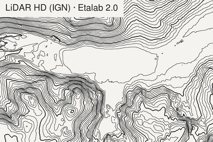
| LiDAR HD, RGE ALTI (IGN, France) | Etalab Open Licence 2.0 | Allowed | Source and date of last update; no implied endorsement |
| 3DEP (USGS, United States) | U.S. public domain | Allowed | Credit requested |
| ArcticDEM, REMA (PGC) | CC BY 4.0 | Allowed (not Alaska from June 2022, not public) | Credit, licence; PGC’s acknowledgement text |
| FABDEM V1-2 (Univ. of Bristol / Fathom) | CC BY-NC-SA 4.0 | Not allowed; commercial licence from Fathom | — |
| FathomDEM (Fathom) | CC BY-NC-SA 4.0, files on request | Not allowed; commercial licence from Fathom | — |
Two of the three open global terrain models, FABDEM and FathomDEM, are non-commercial; GEDTM30 is the one that is not. For what each model measures and how accurate it is, see global elevation models compared.
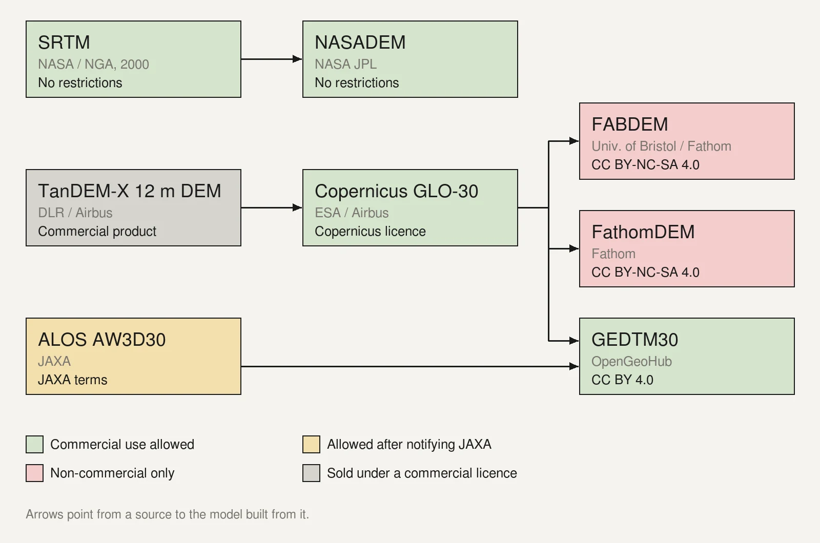
A licence does not pass down a family tree. FABDEM and FathomDEM are both corrections of Copernicus GLO-30, which allows commercial use, and both are non-commercial. GLO-30 is itself a reduced-resolution version of a TanDEM-X model that DLR and Airbus sell. GEDTM30, built from GLO-30 and AW3D30, is CC BY 4.0. What you may do with a print depends first on the licence of the model you downloaded, not on its parents.
What BY, NC, SA and ND mean for a print
Creative Commons licences are built from four elements. The quotes below are from the 4.0 legal code (BY, BY-NC-SA).
BY, attribution. Every CC licence has it. When you share the material, modified or not, you must name the creator, give a copyright notice if one is supplied, name the licence with a link to it, link to the material where reasonably practicable, and say whether you modified it. A contour map is a modification of the grid it was traced from, so the credit should say so (“contours traced from…”). The licence lets you do this “in any reasonable manner based on the medium, means, and context”, including through a link to a page that holds the details. It also forbids presenting your work as endorsed by the creator.
NC, non-commercial. The licence defines it as “not primarily intended for or directed towards commercial advantage or monetary compensation”. A print sold in a shop, a commission for a client and a map in a paid product are all directed towards payment. NC data are for personal projects, teaching and research; for anything else, the data owner may sell a separate licence, as Fathom does for FABDEM and FathomDEM.
SA, share-alike. If you share Adapted Material, you must release it under the same licence (or a compatible one). For a poster traced from BY-NC-SA data, that would mean licensing the poster itself under BY-NC-SA, which lets anyone copy it for non-commercial use. Whether a given map counts as Adapted Material depends on copyright law, which the licence leaves to the courts; Fathom reads it broadly, writing that the licence “requires that any derivatives of FathomDEM are also published under the same license” (Zenodo record). On a non-commercial licence, SA does not change the main point: you can’t sell the print anyway.
ND, no derivatives. You may share the material unchanged, but not Adapted Material. None of the elevation models on this page uses ND; if you meet one, a contour map made from it is the kind of thing it rules out.
Licences outside Creative Commons, such as Copernicus’s, Etalab’s or JAXA’s, use their own wording. Read them for what they ask, not for which CC licence they resemble.
Database rights, in Europe. Copyright is not the only right that can cover a grid of elevations. In the European Union, the database directive gives the maker of a database a separate right, called sui generis, where there has been “a substantial investment in either the obtaining, verification or presentation of the contents”. It lets the maker prevent the extraction or re-use of “the whole or of a substantial part” of those contents (Directive 96/9/EC, art. 7). The CC 4.0 licences cover this right as well: their section 4 lets you extract, reuse and share the contents of the database, on the licence’s conditions (CC BY 4.0, section 4). Whether a contour map traced from a grid uses a substantial part of a database, adapts it or stands as a new work depends on the law that applies where the question is asked; this page does not settle it.
Placing the credit on a print
A print has no hyperlink, so the credit has to be readable on paper or on whatever goes with the paper: the margin, the back, a card in the tube, the product page. Here is a layout that carries what CC BY 4.0 asks for, on a real map.
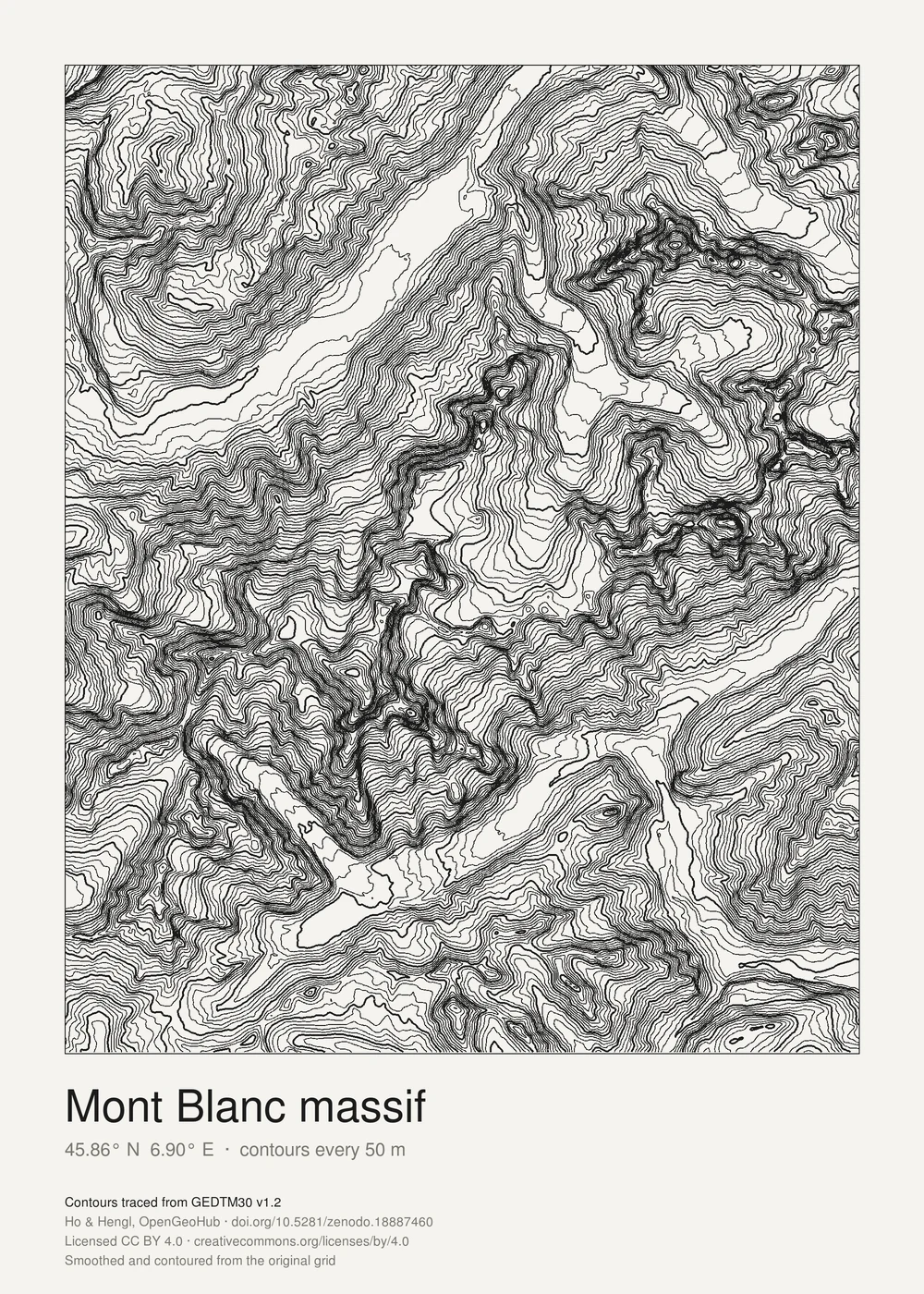
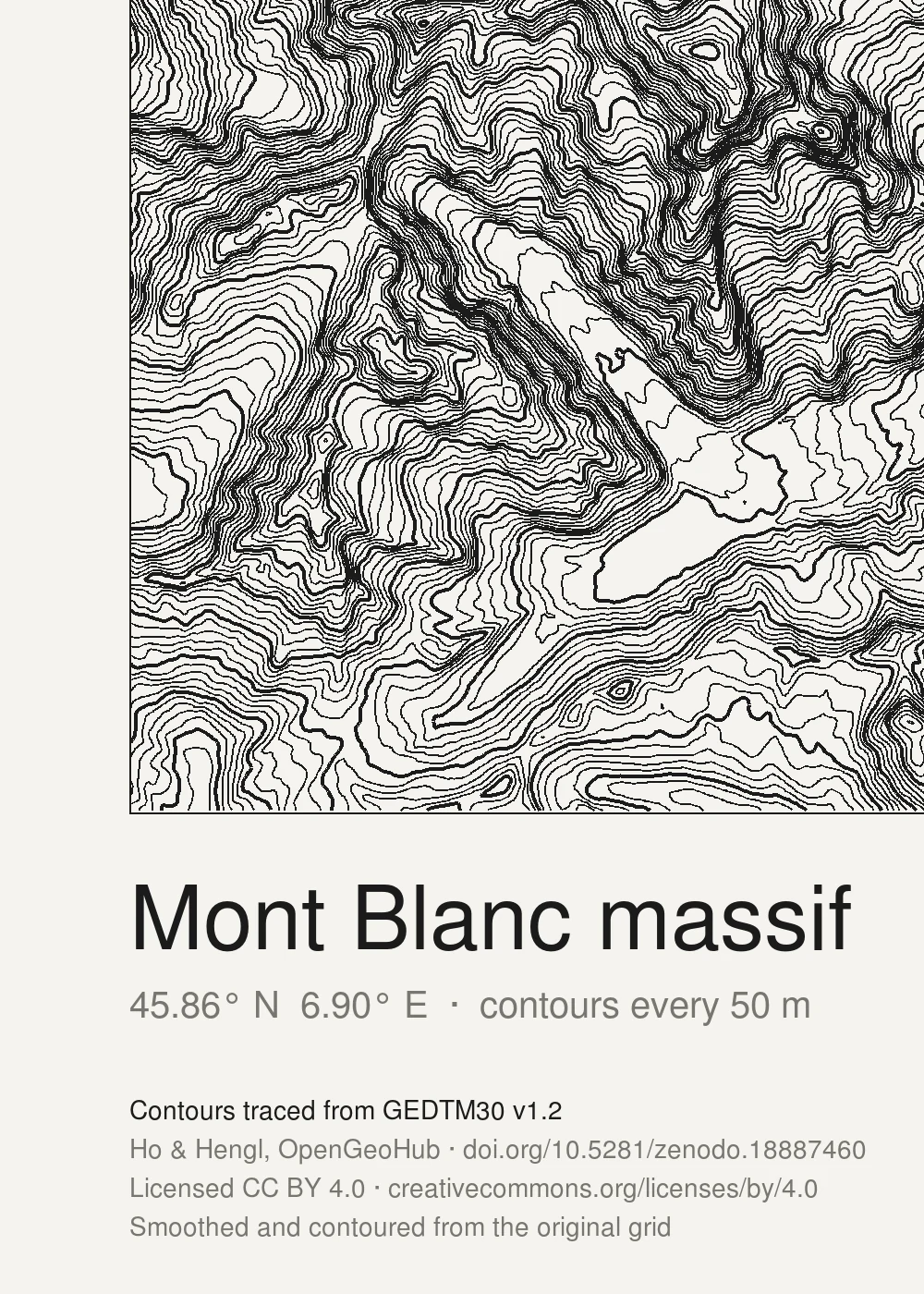
What each source asks, word for word where the licence gives a wording:
- GEDTM30. The creators (Yufeng Ho and Tom Hengl, OpenGeoHub), the licence (CC BY 4.0 with its link), a link to the data (doi.org/10.5281/zenodo.18887460 for v1.2) and a note that you modified it. The repository also gives a citation for the paper (Ho et al., 2025). GEDTM30 is built from other models, Copernicus GLO-30 and ALOS AW3D30 among them, and released by its authors under CC BY 4.0; naming those inputs as well costs one more line.
- Copernicus GLO-30. For data that have been “adapted or modified”, the licence asks for this notice: “produced using Copernicus WorldDEM-30 © DLR e.V. 2010-2014 and © Airbus Defence and Space GmbH 2014-2018 provided under COPERNICUS by the European Union and ESA; all rights reserved”. Anyone who distributes the data, “modified or not”, must also add, in a licence or legal notice: “The organisations in charge of the Copernicus programme by law or by delegation do not incur any liability for any use of the Copernicus WorldDEM-30”. And nothing may suggest that ESA, the EU or Airbus endorse your work (ESA licence, art. 6).
- SRTM / NASADEM. NASA places no restriction on use and does not license its data, but “strongly” urges users to cite them and to acknowledge NASA as the source, and NASA material may not be used to suggest that NASA endorses a commercial product (NASA Earthdata). The DOI for NASADEM is 10.5067/MEASURES/NASADEM/NASADEM_HGT.001.
- ALOS AW3D30. Credit JAXA and the product, for example “Credit: AW3D30 (JAXA)”, one of the formats JAXA suggests, including on any derivative you make public. Commercial use is free, but JAXA asks to be notified in advance (JAXA terms, 2.1 and 2.3). Downloading also needs a free account. These are JAXA’s general terms; check the page of the exact product and version you download, which may add conditions of its own.
- LiDAR HD and RGE ALTI. Etalab 2.0 asks for the source (at least the publisher’s name) and the date of the last update of the data, and accepts a link as a way to give it. Its own example reads like “Ministry of xxx—Original data downloaded from […], updated on 14 February 2017”. For the LiDAR HD terrain model, that gives “IGN, MNT LiDAR HD, data.gouv.fr/datasets/mnt-lidar-hd, updated on 30 September 2026”. The credit must not suggest that IGN endorses your work, nor mislead about the source or the date (Etalab). IGN publishes many products, and each one states its licence on its own metadata record: check the record of the product and version you use rather than assume it carries over.
- USGS 3DEP. USGS data are in the U.S. public domain; the USGS asks for credit in the form “Credit: U.S. Geological Survey” (USGS).
- ArcticDEM and REMA. CC BY 4.0, plus PGC’s acknowledgement, for ArcticDEM: “DEMs provided by the Polar Geospatial Center under NSF-OPP awards 1043681, 1559691, 1542736, 1810976, and 2129685” (PGC).
Data you can’t use at all
Ho’s point about closed data shows up in the open datasets too, as holes:
- France. LiDAR HD and RGE ALTI leave military and sensitive sites (the ZICAD zones) empty (elevation data for France).
- Europe at 10 m. The Copernicus EEA-10 model can be downloaded by eligible users, such as public authorities and EU-funded projects, not by the general public (Copernicus).
- Alaska. ArcticDEM data from June 2022 onward are not public, and most of PGC’s non-polar EarthDEM is restricted to U.S. government users and funded researchers (PGC).
- FathomDEM. Its Zenodo files are released on request, to academic email addresses (Zenodo).
A model that was online yesterday is not necessarily open: a download link says nothing about the licence. Find the licence on the publisher’s own page, for the version you use.
How to check a source
- Find the licence at the publisher, not on a mirror, a forum or a tile service: mirrors sometimes carry an older or different licence. FABDEM’s own repository page states CC BY-NC-SA 4.0 in its description and a “Non-Commercial Government Licence” in its metadata; both forbid commercial use, but the mismatch shows why the text matters more than the label.
- Check the version. Licences and credits change between releases. GEDTM30’s v1.2 has its own DOI (10.5281/zenodo.18887460); Zenodo also gives one DOI for all versions together (10.5281/zenodo.14900180), which leads to the latest. Credit the DOI of the version you traced.
- Look for NC, a “research” or “academic” condition, or an access request. Any of them means a sold print needs a separate licence.
- Write the credit when you trace the map, not when you ship it: the date of the last update and the version are easy to note on the day, hard to find a year later.
- Keep the licence text you relied on, with the date you read it.
Before a print goes on sale, keep these together with its files:
- the exact name of the dataset, such as “Global Ensemble Digital Terrain Model 30m (GEDTM30)”;
- its version and DOI (v1.2.0, 10.5281/zenodo.18887460);
- a copy of the licence text, with the date you saved it;
- the credit, written out as it will be printed;
- the date you downloaded the data.
How we checked
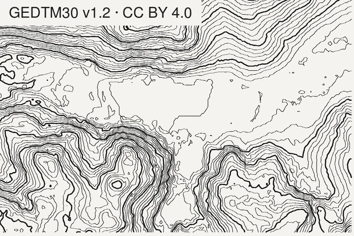
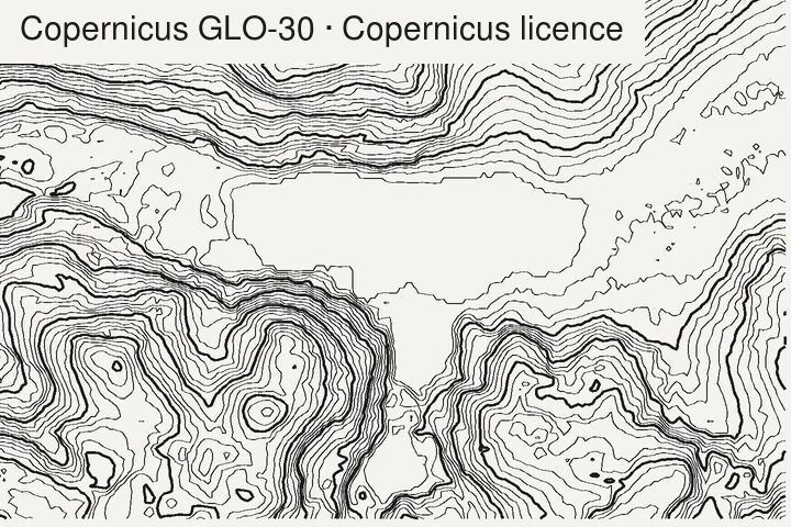
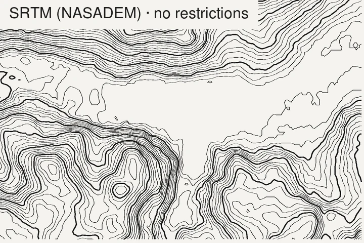
Every licence on this page was read on 11 November 2026 on the publisher’s own site: the Zenodo record of GEDTM30 v1.2 and its Codeberg repository; ESA’s licence document for the Copernicus DEM (issue date 21 February 2025); the database directive on EUR-Lex; the FABDEM V1-2 page on the University of Bristol repository and the FathomDEM records on Zenodo; NASA’s Earthdata data use guidance and the NASADEM catalogue page; JAXA’s terms of use and AW3D30 page; the Etalab Open Licence 2.0 text; the USGS copyrights and credits page; PGC’s product guide and acknowledgement policy; and the Creative Commons 4.0 legal codes. Ho’s remarks are from the recording of his talk, with timestamps in the links. The figures are traced from the data as published, with the same marching-squares code as TopoLines’ exports; the LiDAR HD grid was smoothed over about 6 m before tracing.
Credit for this page’s figures: GEDTM30 v1.2, Ho & Hengl, OpenGeoHub, CC BY 4.0 (doi.org/10.5281/zenodo.18887460); contours produced using Copernicus WorldDEM-30 © DLR e.V. 2010-2014 and © Airbus Defence and Space GmbH 2014-2018 provided under COPERNICUS by the European Union and ESA; all rights reserved (the organisations in charge of the Copernicus programme by law or by delegation do not incur any liability for any use of the Copernicus WorldDEM-30); NASADEM, NASA JPL (doi.org/10.5067/MEASURES/NASADEM/NASADEM_HGT.001); IGN, MNT LiDAR HD, data.gouv.fr/datasets/mnt-lidar-hd, updated on 30 September 2026 (Etalab 2.0). All contours traced and drawn by us from the original grids.
What TopoLines uses
TopoLines traces GEDTM30 by default, and writes the credit of the source that served your
zone into the metadata of every export: the dc:rights field of an SVG, the Attribution
text field of a PNG, the metadata of a GeoJSON file and the header comments of a DXF
(datasets docs). Metadata does not show on paper, so for a print, copy that credit onto the sheet or the product page.
GEDTM30 exists under an open licence because OpenGeoHub chose to build it that way, when the easier path was a non-commercial one. If you sell maps made from it, the credit line is the least you can give back.
Once you know what the data measured and what you may do with it, one question remains: how far off the lines themselves can be. That is the subject of the next page in this series: how far off can a contour line be?
References
- Ho, Y.-F. (2026). Derive and apply multiscale terrain variables in environmental research. OpenGeoHub Earth Observation Summer School 2026, Istanbul (recorded talk).
- Ho, Y.-F., Grohmann, C. H., Lindsay, J., Reuter, H. I., Parente, L., Witjes, M. & Hengl, T. (2025). GEDTM30: global ensemble digital terrain model at 30 m and derived multiscale terrain variables. PeerJ 13, e19673. doi:10.7717/peerj.19673
- Ho, Y. & Hengl, T. (2026). Global Ensemble Digital Terrain Model 30m (GEDTM30), v1.2.0. Zenodo. doi:10.5281/zenodo.18887460
- Creative Commons (2013). Attribution 4.0 International Public License (legal code).
- Creative Commons (2013). Attribution-NonCommercial-ShareAlike 4.0 International Public License (legal code).
- European Space Agency (2025). Licence for Copernicus DEM instance COP-DEM-GLO-30-F Global 30m Full, Free & Open. In: Copernicus Contributing Mission Data Access licences (issue date 21/02/2025).
- Neal, J. & Hawker, L. (2023). FABDEM V1-2. University of Bristol data repository. doi:10.5523/bris.s5hqmjcdj8yo2ibzi9b4ew3sn
- Hawker, L., Uhe, P., Paulo, L., Sosa, J., Savage, J., Sampson, C. & Neal, J. (2022). A 30 m global map of elevation with forests and buildings removed. Environmental Research Letters 17, 024016. doi:10.1088/1748-9326/ac4d4f
- Fathom (2024). FathomDEM v1-0 Eurasia and Africa. Zenodo (restricted files).
- NASA JPL (2020). NASADEM Merged DEM Global 1 arc second V001. NASA Land Processes DAAC. doi:10.5067/MEASURES/NASADEM/NASADEM_HGT.001
- NASA Earthdata (2026). Data use guidance.
- JAXA (2026). Terms of Use of Research Data. Space Technology Directorate I.
- Etalab (2017). Open Licence 2.0 / Licence Ouverte 2.0.
- U.S. Geological Survey (2026). Copyrights and credits.
- Polar Geospatial Center (2026). PGC DEM products: ArcticDEM, REMA and EarthDEM.
- European Parliament and Council of the European Union (1996). Directive 96/9/EC of 11 March 1996 on the legal protection of databases. Official Journal of the European Communities L 77, 20–28.
Last updated 11 November 2026