Topographic map
of Turin
Piedmont, Italy — 50 m contours over bare-earth elevation data.
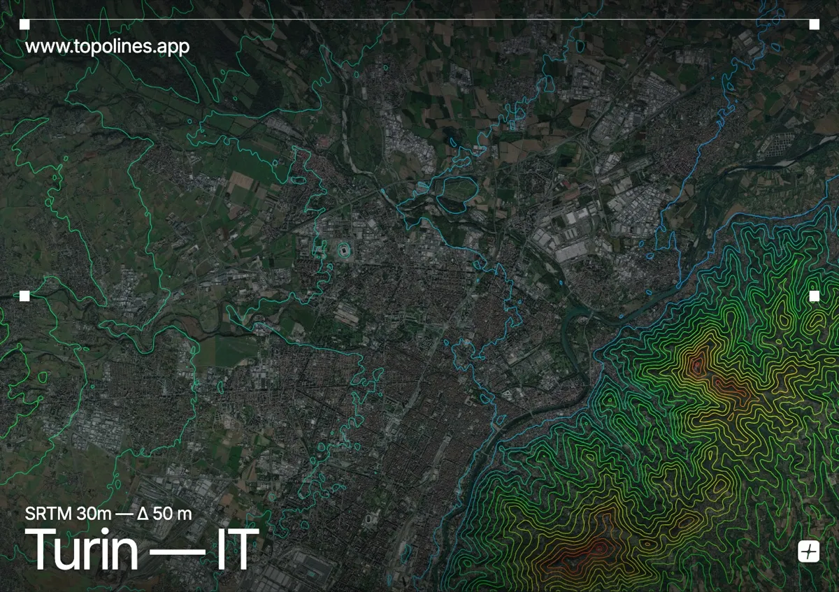
Turin sits on the flat Po plain with a wooded hill rising directly across the river to the east and the whole western Alpine arc filling the horizon beyond. The city's grid is dead flat, but relief frames it on two sides — the Turin hill close at hand, the Alps in the distance.
The Collina di Torino climbs immediately east of the Po to around 700 m, crowned by the Superga basilica, while to the west and north the Cottian and Graian Alps rise as a distant snow wall around Monviso and the Gran Paradiso. On the map the flat plain and the straight river separate two very different reliefs: the compact contours of the near hill and the far Alpine front.
How this map was made
Every contour line traces a constant elevation drawn from the public GEDTM30 30 m bare-earth terrain model, extracted with a marching-squares algorithm at a 50 m interval and coloured by height — cool blues in the valley climbing to warm reds on the summits. The satellite base layer and the contours share the same Web Mercator projection, so the lines fall exactly on the ground they describe.
You can regenerate this exact view — and change the interval, colours, resolution or export it as a print-ready SVG — directly in the TopoLines editor.