Topographic map
of Almaty
Zhetysu, Kazakhstan — 100 m contours over bare-earth elevation data.
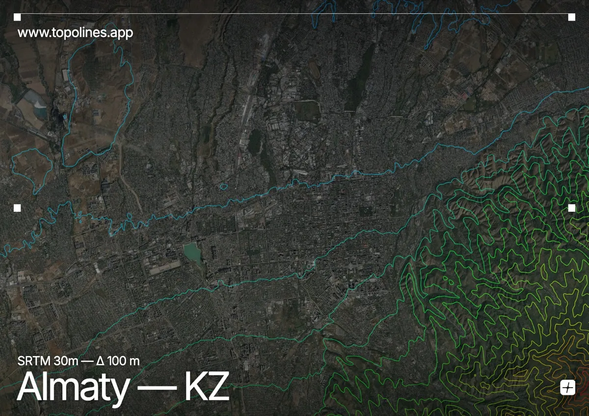
Almaty spreads across the sloping foothills of the Zailiysky Alatau, the northernmost wall of the Tian Shan, which rises in a snow-capped front directly above the city. The whole city tilts, its streets climbing steadily from the plain toward the mountains to the south.
The Zailiysky Alatau lifts to peaks above 4,000 m — Talgar and its neighbours — within a short distance of the southern suburbs, drained by steep gorges that carry meltwater through the city. To the north the ground eases onto the Kazakh steppe. On the map the southern edge is a dense, continuous mountain band and the built area a slope of widening contours running down to the plain.
How this map was made
Every contour line traces a constant elevation drawn from the public GEDTM30 30 m bare-earth terrain model, extracted with a marching-squares algorithm at a 100 m interval and coloured by height — cool blues in the valley climbing to warm reds on the summits. The satellite base layer and the contours share the same Web Mercator projection, so the lines fall exactly on the ground they describe.
You can regenerate this exact view — and change the interval, colours, resolution or export it as a print-ready SVG — directly in the TopoLines editor.