Topographic map
of Annecy
Haute-Savoie, France — 50 m contours over bare-earth elevation data.
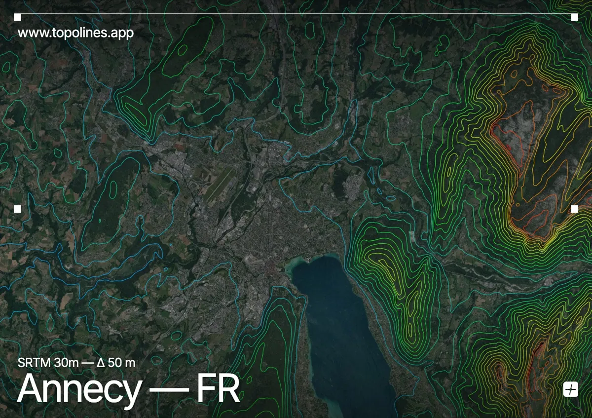
Annecy stands at the northern tip of its glacial lake, hemmed in by the Bauges massif and the sharp summit of La Tournette. The lake basin is a textbook glacial trough, and the contours wrap its shores in tight, parallel bands.
The Semnoz ridge rises immediately to the west, La Tournette to the southeast passes 2,350 m, and the Dents de Lanfon serrate the eastern shore. On the map the flat lake and its plain read as open space, ringed by densely packed contours that climb into the pre-alpine limestone on every side.
How this map was made
Every contour line traces a constant elevation drawn from the public GEDTM30 30 m bare-earth terrain model, extracted with a marching-squares algorithm at a 50 m interval and coloured by height — cool blues in the valley climbing to warm reds on the summits. The satellite base layer and the contours share the same Web Mercator projection, so the lines fall exactly on the ground they describe.
You can regenerate this exact view — and change the interval, colours, resolution or export it as a print-ready SVG — directly in the TopoLines editor.