Topographic map
of Grenoble
Auvergne-Rhône-Alpes, France — 50 m contours over bare-earth elevation data.
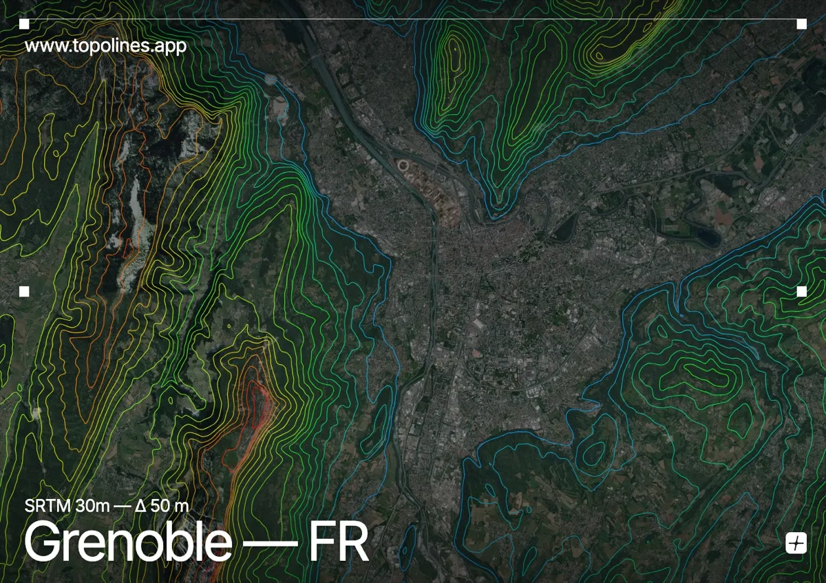
Grenoble sits on a flat alluvial plain at the Y-shaped confluence of the Isère and Drac rivers, ringed on three sides by mountains. Few cities in Europe show such an abrupt jump from valley floor to high relief, which is exactly what a contour map makes legible.
Three massifs enclose the city. To the west the limestone cliffs of the Vercors rise in a near-vertical wall; to the north the Chartreuse climbs toward the Dent de Crolles; and to the east the crystalline peaks of Belledonne pass 2,000 m within a few kilometres of the centre. On the map the contour lines pack tightly against these fronts and open out across the plain, tracing the sharp boundary between the built valley and the surrounding relief.
How this map was made
Every contour line traces a constant elevation drawn from the public GEDTM30 30 m bare-earth terrain model, extracted with a marching-squares algorithm at a 50 m interval and coloured by height — cool blues in the valley climbing to warm reds on the summits. The satellite base layer and the contours share the same Web Mercator projection, so the lines fall exactly on the ground they describe.
You can regenerate this exact view — and change the interval, colours, resolution or export it as a print-ready SVG — directly in the TopoLines editor.