Topographic map
of Amalfi
Campania, Italy — 100 m contours over bare-earth elevation data.
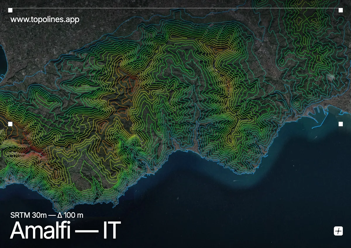
Amalfi clings to a ravine on the southern flank of the Sorrentine Peninsula, where the Monti Lattari fall in sheer cliffs to the Tyrrhenian Sea. The town is built into the mouth of a gorge, its houses stacked up the walls of a valley that climbs almost vertically behind the harbour.
The Monti Lattari wall the coast to the north, Monte Cerreto and Monte Sant'Angelo a Tre Pizzi topping 1,300–1,400 m within a few kilometres of the water. Deep gorges — the Valle delle Ferriere among them — carve down to the villages of the Amalfi Coast. On the map the relief is relentless: dense contours pressed hard against an intricate, cliff-lined shore.
How this map was made
Every contour line traces a constant elevation drawn from the public GEDTM30 30 m bare-earth terrain model, extracted with a marching-squares algorithm at a 100 m interval and coloured by height — cool blues in the valley climbing to warm reds on the summits. The satellite base layer and the contours share the same Web Mercator projection, so the lines fall exactly on the ground they describe.
You can regenerate this exact view — and change the interval, colours, resolution or export it as a print-ready SVG — directly in the TopoLines editor.