Topographic map
of Trondheim
Trøndelag, Norway — 50 m contours over bare-earth elevation data.
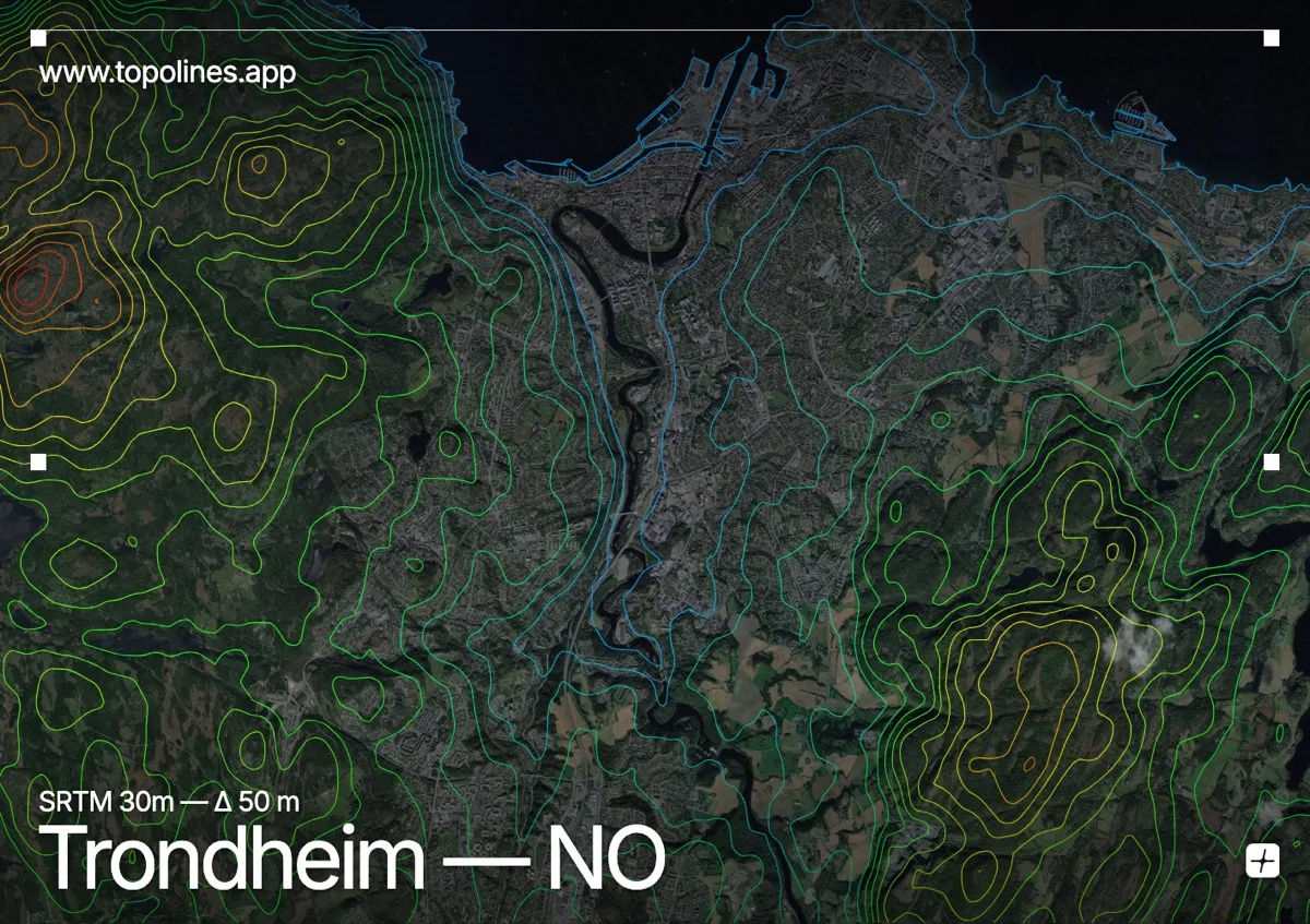
Trondheim sits where the Nidelva river loops into the broad Trondheimsfjord, backed by the forested hills of the Bymarka. Norway's third city has a gentler setting than the western fjords, but the fjord and wooded ridges still frame it closely.
The Nidelva's tight meander wraps the old town, the Trondheimsfjord opens to the north, and the Bymarka rises to Gråkallen at 552 m immediately west of the built area. On the map the river loop and the fjord read as open water threading a landscape of low, rounded contour — a softer, more sinuous relief than the sheer fjords further south and west.
How this map was made
Every contour line traces a constant elevation drawn from the public GEDTM30 30 m bare-earth terrain model, extracted with a marching-squares algorithm at a 50 m interval and coloured by height — cool blues in the valley climbing to warm reds on the summits. The satellite base layer and the contours share the same Web Mercator projection, so the lines fall exactly on the ground they describe.
You can regenerate this exact view — and change the interval, colours, resolution or export it as a print-ready SVG — directly in the TopoLines editor.