Topographic map
of Tromsø
Troms, Norway — 100 m contours over bare-earth elevation data.
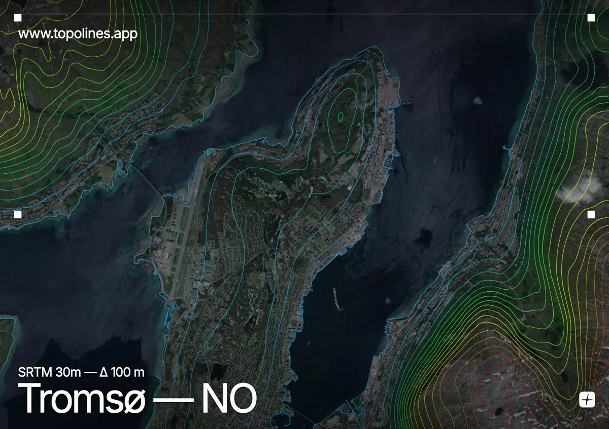
Tromsø, the largest city in Arctic Norway, sits on a narrow island between the mainland and Kvaløya, ringed by snow peaks that drop straight to the sound. Well north of the Arctic Circle, it looks across the water to the sharp pyramid of Tromsdalstinden.
Tromsdalstinden rises to 1,238 m on the mainland side directly opposite the centre, while the jagged summits of Kvaløya wall the western channel and the flat island of Tromsøya carries the city itself. On the map the built island reads as low open ground pinched between two sounds, framed on both sides by the tightly packed contours of peaks that climb over a vertical kilometre from sea level.
How this map was made
Every contour line traces a constant elevation drawn from the public GEDTM30 30 m bare-earth terrain model, extracted with a marching-squares algorithm at a 100 m interval and coloured by height — cool blues in the valley climbing to warm reds on the summits. The satellite base layer and the contours share the same Web Mercator projection, so the lines fall exactly on the ground they describe.
You can regenerate this exact view — and change the interval, colours, resolution or export it as a print-ready SVG — directly in the TopoLines editor.