Topographic map
of Thimphu
Himalaya, Bhutan — 100 m contours over bare-earth elevation data.
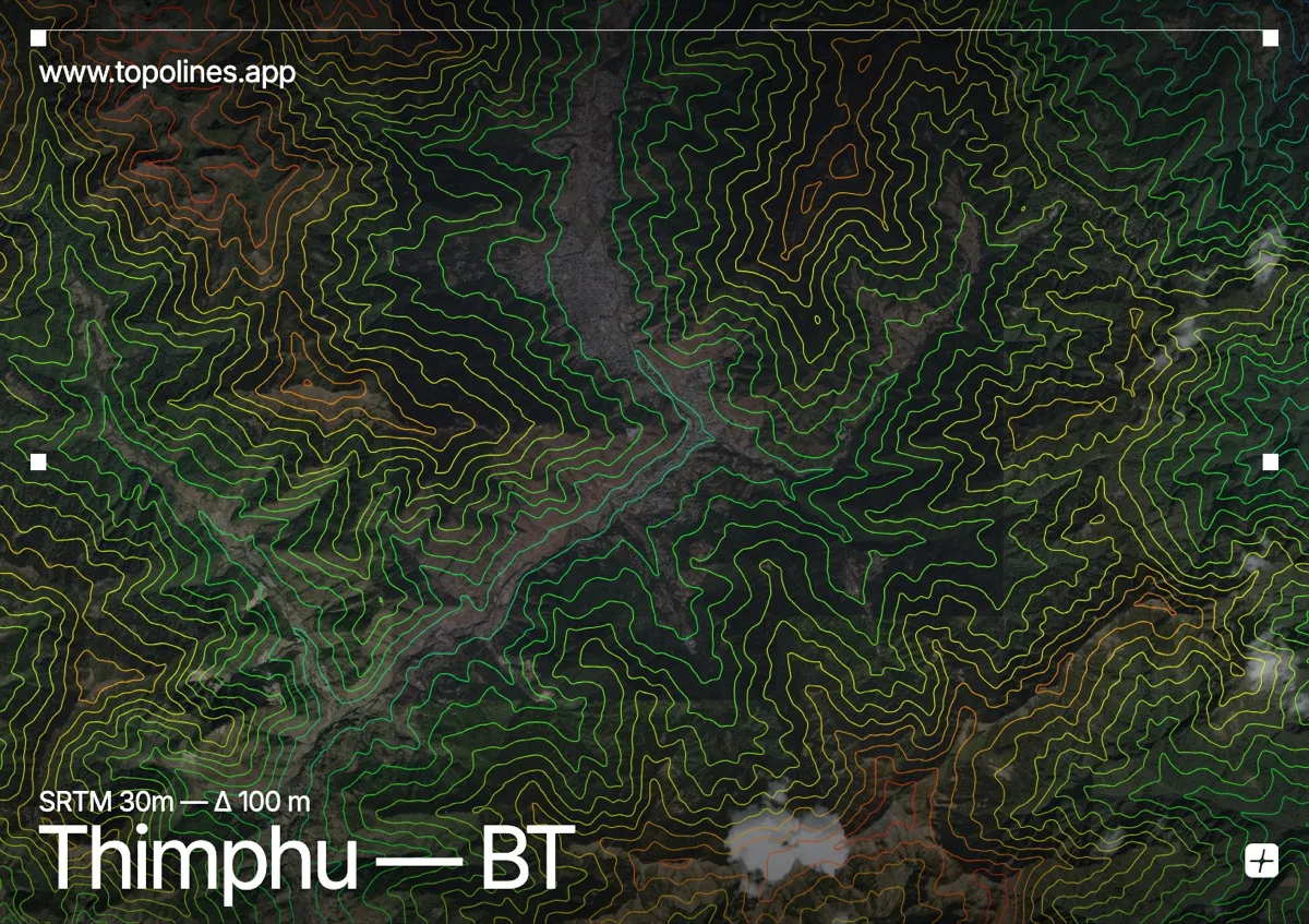
Thimphu, Bhutan's capital, runs along the floor of a steep Himalayan valley at about 2,334 m, with forested ridges rising sharply on either side. There are no traffic lights and no railway — the terrain keeps the city strung out along the Wang Chhu river.
The valley walls climb toward 3,500–3,800 m within a short distance of the centre, cloaked in blue-pine forest and topped by ridgelines that carry monasteries and prayer flags. The Wang Chhu threads the flat valley bottom. On the map the contours squeeze in tightly from both sides, leaving a narrow ribbon of open ground — the classic form of a high Himalayan valley town.
How this map was made
Every contour line traces a constant elevation drawn from the public GEDTM30 30 m bare-earth terrain model, extracted with a marching-squares algorithm at a 100 m interval and coloured by height — cool blues in the valley climbing to warm reds on the summits. The satellite base layer and the contours share the same Web Mercator projection, so the lines fall exactly on the ground they describe.
You can regenerate this exact view — and change the interval, colours, resolution or export it as a print-ready SVG — directly in the TopoLines editor.