Topographic map
of Tbilisi
Caucasus, Georgia — 50 m contours over bare-earth elevation data.
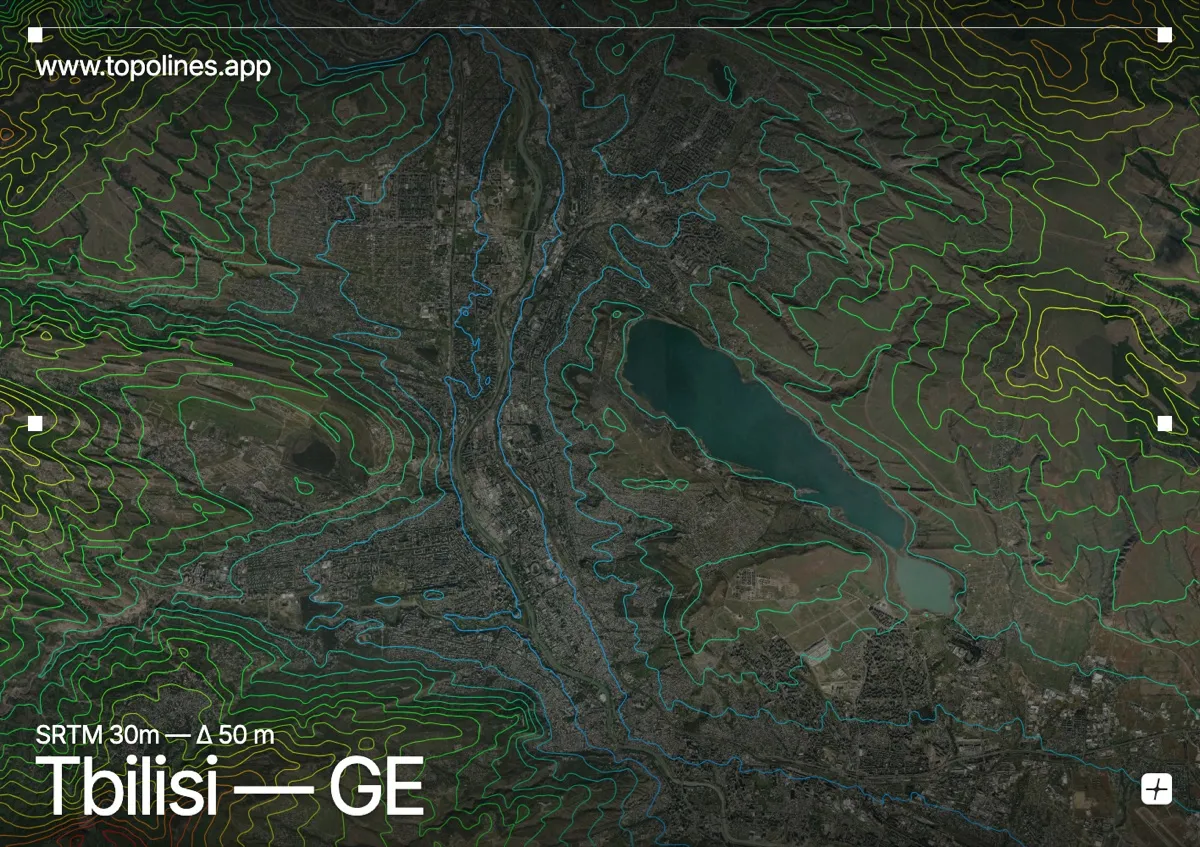
Tbilisi curves along the Mtkvari river where it cuts through the foothills of the Trialeti range, the old town climbing the slopes beneath the Narikala fortress. The city is wrapped tightly around the river gorge, with hills rising directly from the historic quarters.
Mtatsminda rises to around 770 m immediately above the centre, and the wooded ridges of the Trialeti Range climb toward 1,400 m on the surrounding heights. The Mtkvari threads a winding corridor through the middle, pinched between slopes on both banks. On the map the river valley reads as a sinuous open channel framed by the tight contours of the enclosing foothills.
How this map was made
Every contour line traces a constant elevation drawn from the public GEDTM30 30 m bare-earth terrain model, extracted with a marching-squares algorithm at a 50 m interval and coloured by height — cool blues in the valley climbing to warm reds on the summits. The satellite base layer and the contours share the same Web Mercator projection, so the lines fall exactly on the ground they describe.
You can regenerate this exact view — and change the interval, colours, resolution or export it as a print-ready SVG — directly in the TopoLines editor.