Topographic map
of Sarajevo
Sarajevo Canton, Bosnia and Herzegovina — 50 m contours over bare-earth elevation data.
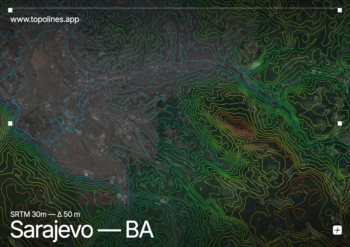
Sarajevo lies in a long, narrow valley along the Miljacka river, enclosed by the Dinaric Alps on every side. The city stretches thin between the slopes, and the surrounding mountains — Olympic peaks in 1984 — rise steeply from the built floor.
Trebević overlooks the old town from the south, with Bjelašnica and Igman climbing toward 2,000 m beyond it and Ozren closing the north. The valley's tight geometry funnels the city into a ribbon; on the map the contours squeeze in from both sides, tracing the classic elongated basin of the Dinarides.
How this map was made
Every contour line traces a constant elevation drawn from the public GEDTM30 30 m bare-earth terrain model, extracted with a marching-squares algorithm at a 50 m interval and coloured by height — cool blues in the valley climbing to warm reds on the summits. The satellite base layer and the contours share the same Web Mercator projection, so the lines fall exactly on the ground they describe.
You can regenerate this exact view — and change the interval, colours, resolution or export it as a print-ready SVG — directly in the TopoLines editor.