Topographic map
of Santorini
Cyclades, Aegean Sea, Greece — 50 m contours over bare-earth elevation data.
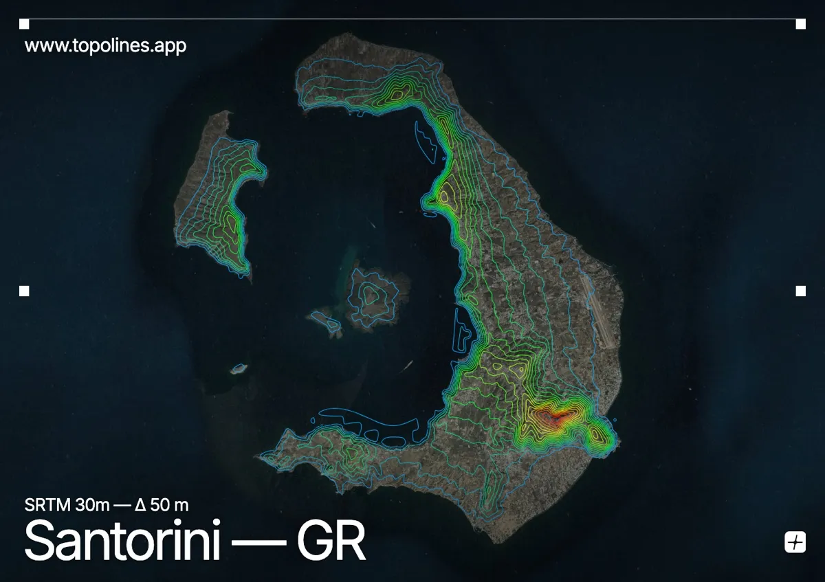
Santorini is the rim of a drowned volcano, a crescent of cliffs standing over a flooded caldera in the southern Aegean. Its main towns, Fira and Oia, perch on the caldera edge some 250 m above the water, looking straight down the volcanic wall to the sea.
The caldera cliffs drop almost vertically on the inner, western side, while the island's outer slopes fall away gently eastward to the beaches. Profitis Ilias, the old limestone high point, tops 567 m to the southeast, and the black volcanic cones of Nea Kameni rise from the centre of the bay. On the map the island reads unmistakably: a tight arc of contours packed along the caldera rim, opening out across the gentler eastern flank.
How this map was made
Every contour line traces a constant elevation drawn from the public GEDTM30 30 m bare-earth terrain model, extracted with a marching-squares algorithm at a 50 m interval and coloured by height — cool blues in the valley climbing to warm reds on the summits. The satellite base layer and the contours share the same Web Mercator projection, so the lines fall exactly on the ground they describe.
You can regenerate this exact view — and change the interval, colours, resolution or export it as a print-ready SVG — directly in the TopoLines editor.