Topographic map
of Salzburg
Salzburg, Austria — 50 m contours over bare-earth elevation data.
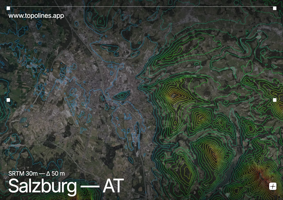
Salzburg lies on the Salzach river where the Alpine foothills give way to the plain, with isolated crags rising straight out of the old town. The Untersberg looms to the south as a massive limestone block on the German border.
The Mönchsberg and Kapuzinerberg push up as wooded ridges within the city itself, while the Gaisberg rounds the eastern skyline and the Untersberg's 1,850 m plateau anchors the south. The map shows a city sitting right at the hinge between flat lowland contours and the sudden rise of the Northern Limestone Alps.
How this map was made
Every contour line traces a constant elevation drawn from the public GEDTM30 30 m bare-earth terrain model, extracted with a marching-squares algorithm at a 50 m interval and coloured by height — cool blues in the valley climbing to warm reds on the summits. The satellite base layer and the contours share the same Web Mercator projection, so the lines fall exactly on the ground they describe.
You can regenerate this exact view — and change the interval, colours, resolution or export it as a print-ready SVG — directly in the TopoLines editor.