Topographic map
of Quito
Pichincha, Ecuador — 100 m contours over bare-earth elevation data.
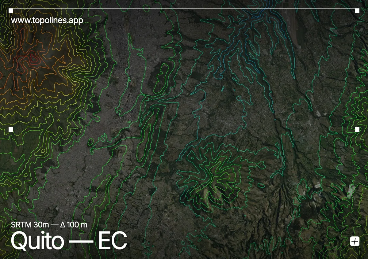
Quito stretches as a long, narrow ribbon along the eastern foot of the Pichincha volcano, in a high Andean valley at 2,850 m. The city is squeezed against the mountain, barely a few kilometres wide but more than forty long, hemmed by relief on both flanks.
Rucu and Guagua Pichincha rise directly to the west, their summits passing 4,600–4,780 m within sight of the old town, while the isolated Panecillo hill breaks the centre and the eastern ridges close the valley opposite. On the map the contours pack hard against the volcano on the western edge and step down across the elongated valley floor, tracing one of the most linear mountain cities anywhere.
How this map was made
Every contour line traces a constant elevation drawn from the public GEDTM30 30 m bare-earth terrain model, extracted with a marching-squares algorithm at a 100 m interval and coloured by height — cool blues in the valley climbing to warm reds on the summits. The satellite base layer and the contours share the same Web Mercator projection, so the lines fall exactly on the ground they describe.
You can regenerate this exact view — and change the interval, colours, resolution or export it as a print-ready SVG — directly in the TopoLines editor.