Topographic map
of Menton
Alpes-Maritimes, France — 100 m contours over bare-earth elevation data.
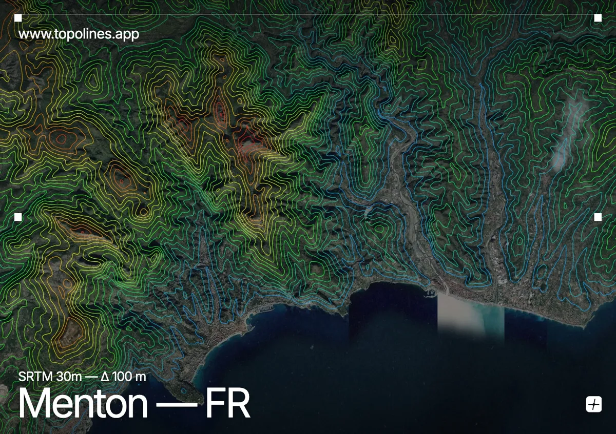
Menton, the last town on the French Riviera before Italy, sits in a sheltered bay where the Maritime Alps come down almost to the shoreline. The mountains rise so quickly behind the town that its microclimate — warm enough for lemon groves — is a direct product of the wall of relief at its back.
The Berceau and Mont Gramondo climb past 1,000–1,300 m within a few kilometres of the sea, with the Roya and Careï valleys cutting steep corridors inland toward the Alpine border. On the map the coastal plain is a sliver, and the contours behind it stack almost immediately into one of the sharpest sea-to-summit gradients on the whole Riviera.
How this map was made
Every contour line traces a constant elevation drawn from the public GEDTM30 30 m bare-earth terrain model, extracted with a marching-squares algorithm at a 100 m interval and coloured by height — cool blues in the valley climbing to warm reds on the summits. The satellite base layer and the contours share the same Web Mercator projection, so the lines fall exactly on the ground they describe.
You can regenerate this exact view — and change the interval, colours, resolution or export it as a print-ready SVG — directly in the TopoLines editor.