Topographic map
of Malta
Central Mediterranean, Malta — 20 m contours over bare-earth elevation data.
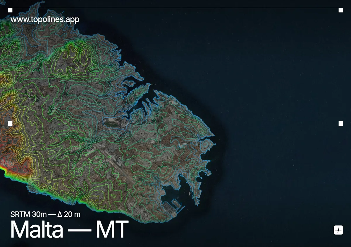
Malta is a low limestone island in the middle of the Mediterranean, tilted so that its southwest coast ends in cliffs while the northeast slopes gently to the sea. Its highest point, near Dingli, reaches only 253 m.
The island's structure is a tilted block: the Dingli Cliffs drop straight into the sea on the southwest, and the land falls away steadily toward the harbours of Valletta on the opposite shore. A series of fault ridges — the Victoria Lines among them — cross the island. On the map the relief is subtle but highly organised, and the deeply indented coastline does much of the drawing.
How this map was made
Every contour line traces a constant elevation drawn from the public GEDTM30 30 m bare-earth terrain model, extracted with a marching-squares algorithm at a 20 m interval and coloured by height — cool blues in the valley climbing to warm reds on the summits. The satellite base layer and the contours share the same Web Mercator projection, so the lines fall exactly on the ground they describe.
You can regenerate this exact view — and change the interval, colours, resolution or export it as a print-ready SVG — directly in the TopoLines editor.