Topographic map
of La Paz
Altiplano, Bolivia — 100 m contours over bare-earth elevation data.
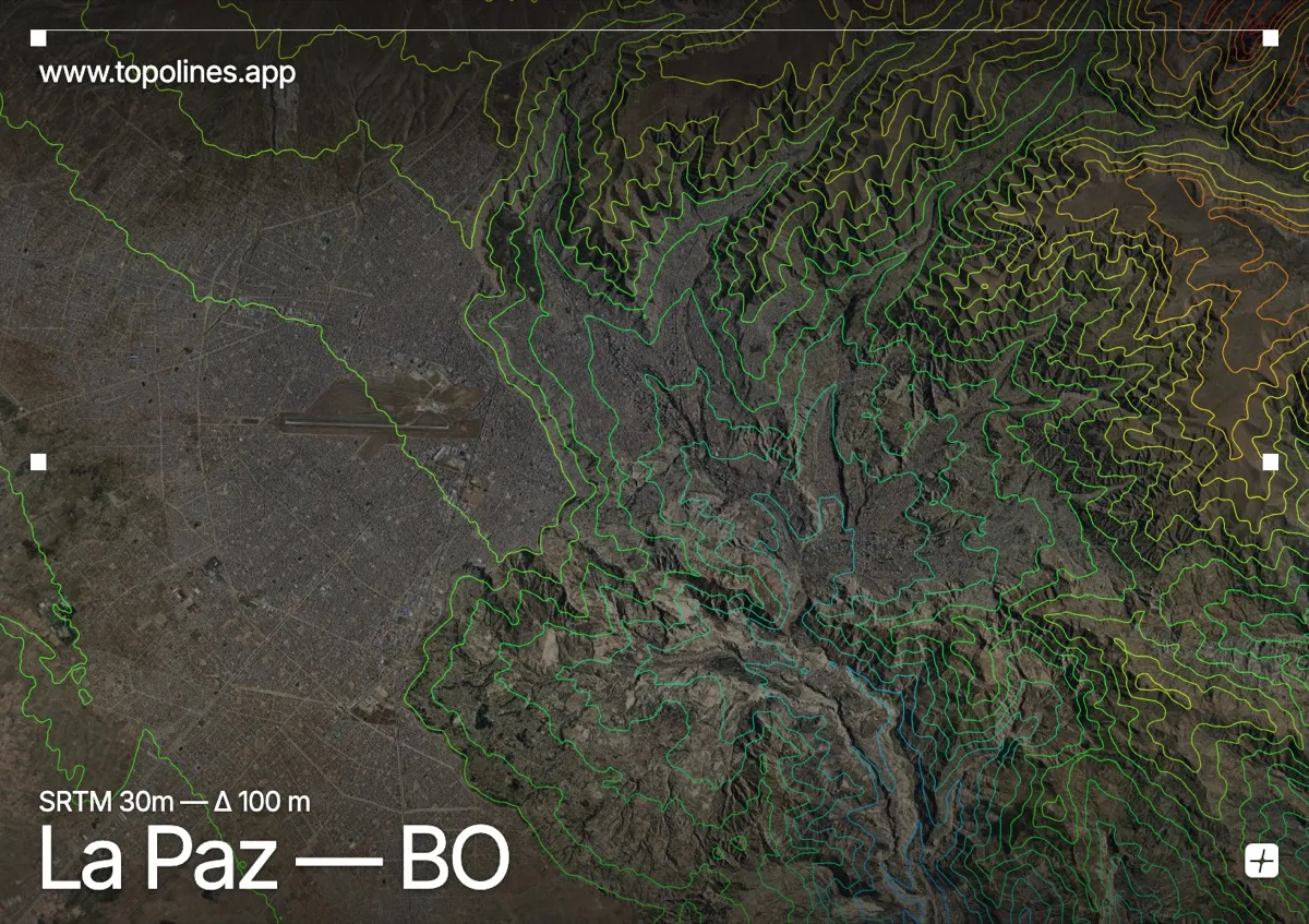
La Paz is built into a vast canyon gouged out of the Altiplano, the highest administrative capital in the world. The city drops more than 900 m from the rim at El Alto to the wealthier valley floors, so altitude — and the relief that comes with it — shapes every neighbourhood.
The flat altiplano surface sits near 4,100 m at El Alto, then the ground plunges into a maze of eroded ravines and side-canyons that carry the city down toward 3,200 m. The snow peak of Illimani looms to the southeast above 6,400 m and Huayna Potosí to the north. On the map the effect is unmistakable: an open high plateau abruptly torn open by a dense fan of contours draining into the basin.
How this map was made
Every contour line traces a constant elevation drawn from the public GEDTM30 30 m bare-earth terrain model, extracted with a marching-squares algorithm at a 100 m interval and coloured by height — cool blues in the valley climbing to warm reds on the summits. The satellite base layer and the contours share the same Web Mercator projection, so the lines fall exactly on the ground they describe.
You can regenerate this exact view — and change the interval, colours, resolution or export it as a print-ready SVG — directly in the TopoLines editor.