Topographic map
of Kathmandu
Bagmati, Nepal — 100 m contours over bare-earth elevation data.
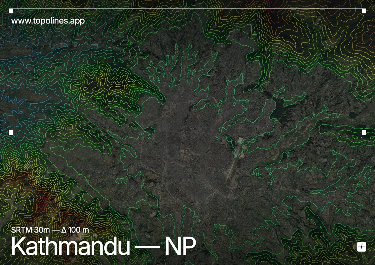
Kathmandu occupies an ancient lake bed at 1,400 m, a flat bowl completely encircled by forested hills. The valley rim tops 2,700 m, and beyond it the Himalaya rise further still.
Shivapuri closes the north, Phulchowki the southeast, and the ring of ridges is broken only where the Bagmati river cuts out through a gorge. On the map the effect is striking: an open, gently contoured floor surrounded on all sides by a continuous band of dense relief — one of the most clearly defined valley basins anywhere.
How this map was made
Every contour line traces a constant elevation drawn from the public GEDTM30 30 m bare-earth terrain model, extracted with a marching-squares algorithm at a 100 m interval and coloured by height — cool blues in the valley climbing to warm reds on the summits. The satellite base layer and the contours share the same Web Mercator projection, so the lines fall exactly on the ground they describe.
You can regenerate this exact view — and change the interval, colours, resolution or export it as a print-ready SVG — directly in the TopoLines editor.