Topographic map
of Innsbruck
Tyrol, Austria — 100 m contours over bare-earth elevation data.
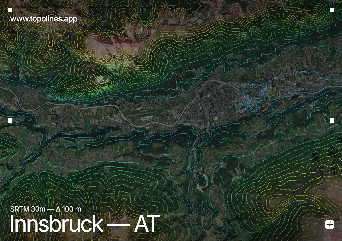
Innsbruck fills the flat floor of the Inn valley with the Nordkette rising like a wall directly above the city, its ridge topping 2,300 m barely two kilometres from the old town. Nowhere in the Alps does a major city sit so tightly beneath such steep relief.
To the north the Karwendel range presents an almost sheer front — the contours there are among the densest on any city map. To the south the ground climbs more evenly toward the Patscherkofel and the Tux Alps. The Inn threads the valley floor between them, a flat ribbon splitting two very different slopes.
How this map was made
Every contour line traces a constant elevation drawn from the public GEDTM30 30 m bare-earth terrain model, extracted with a marching-squares algorithm at a 100 m interval and coloured by height — cool blues in the valley climbing to warm reds on the summits. The satellite base layer and the contours share the same Web Mercator projection, so the lines fall exactly on the ground they describe.
You can regenerate this exact view — and change the interval, colours, resolution or export it as a print-ready SVG — directly in the TopoLines editor.