Topographic map
of Hong Kong
Pearl River Delta, China — 50 m contours over bare-earth elevation data.
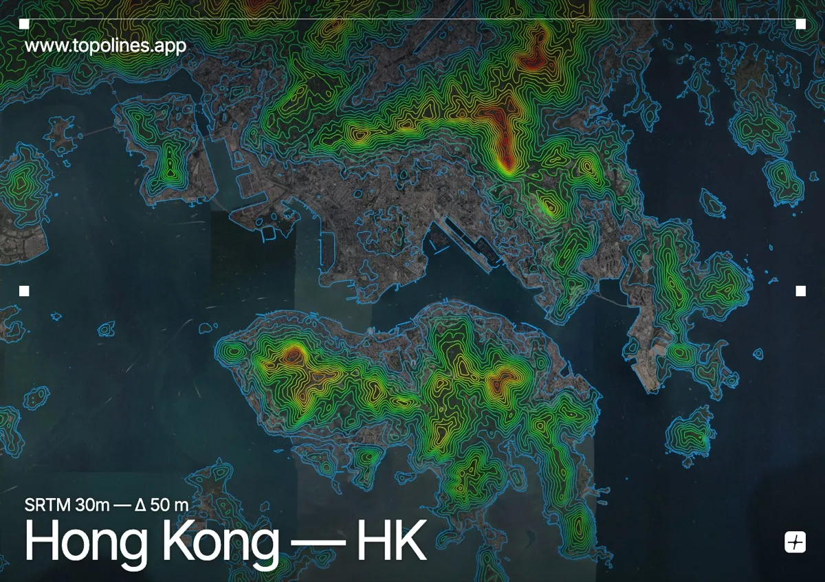
Hong Kong packs one of the world's densest skylines onto a thin coastal shelf beneath steep green peaks that rise straight from the harbour. Victoria Peak climbs to 552 m directly above the towers of Hong Kong Island, and the terrain leaves almost no flat ground for the city.
Victoria Peak dominates the island's spine, dropping sheer to Central and the harbour, while across the water the Kowloon hills and Lion Rock wall in the peninsula. Reclaimed flats hug the shoreline; everything else is slope. On the map the harbour reads as a clean open channel bracketed by tight, near-concentric contours packing up the peaks on both sides.
How this map was made
Every contour line traces a constant elevation drawn from the public GEDTM30 30 m bare-earth terrain model, extracted with a marching-squares algorithm at a 50 m interval and coloured by height — cool blues in the valley climbing to warm reds on the summits. The satellite base layer and the contours share the same Web Mercator projection, so the lines fall exactly on the ground they describe.
You can regenerate this exact view — and change the interval, colours, resolution or export it as a print-ready SVG — directly in the TopoLines editor.