Topographic map
of Cinque Terre
Liguria, Italy — 50 m contours over bare-earth elevation data.
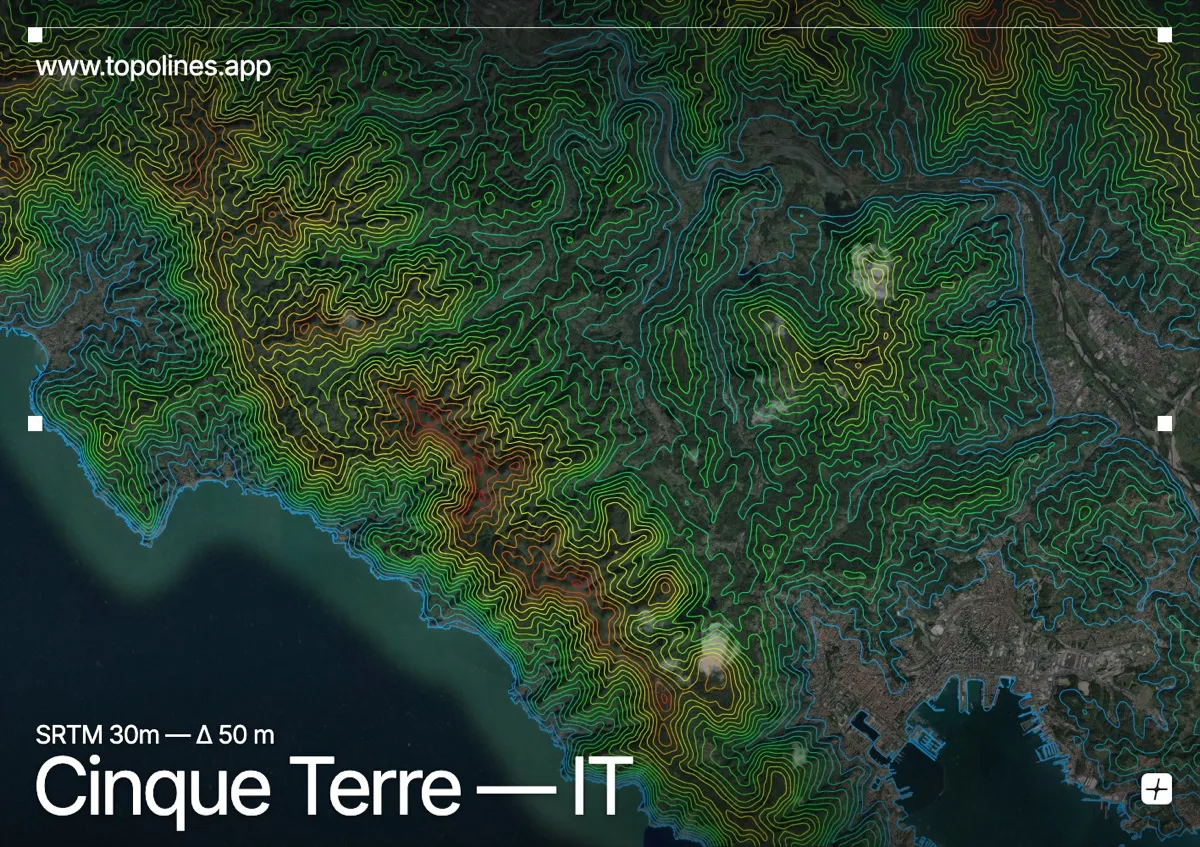
The Cinque Terre are five villages wedged into near-vertical terraced cliffs on the Ligurian coast, with almost no level ground between the sea and the ridge behind. Vineyards climb the slopes on dry-stone walls, and the terrain is so steep the villages had no road access for centuries.
Behind the coast the ridge culminates at Monte Malpertuso around 810 m, with Punta Mesco anchoring the western headland above Monterosso. Short, plunging valleys drop each village straight to the water. On the map the effect is dramatic: the contours crowd into an almost solid band the moment they leave the shoreline, tracing one of the steepest inhabited coastlines in the Mediterranean.
How this map was made
Every contour line traces a constant elevation drawn from the public GEDTM30 30 m bare-earth terrain model, extracted with a marching-squares algorithm at a 50 m interval and coloured by height — cool blues in the valley climbing to warm reds on the summits. The satellite base layer and the contours share the same Web Mercator projection, so the lines fall exactly on the ground they describe.
You can regenerate this exact view — and change the interval, colours, resolution or export it as a print-ready SVG — directly in the TopoLines editor.