Topographic map
of Chongqing
Sichuan Basin, China — 100 m contours over bare-earth elevation data.
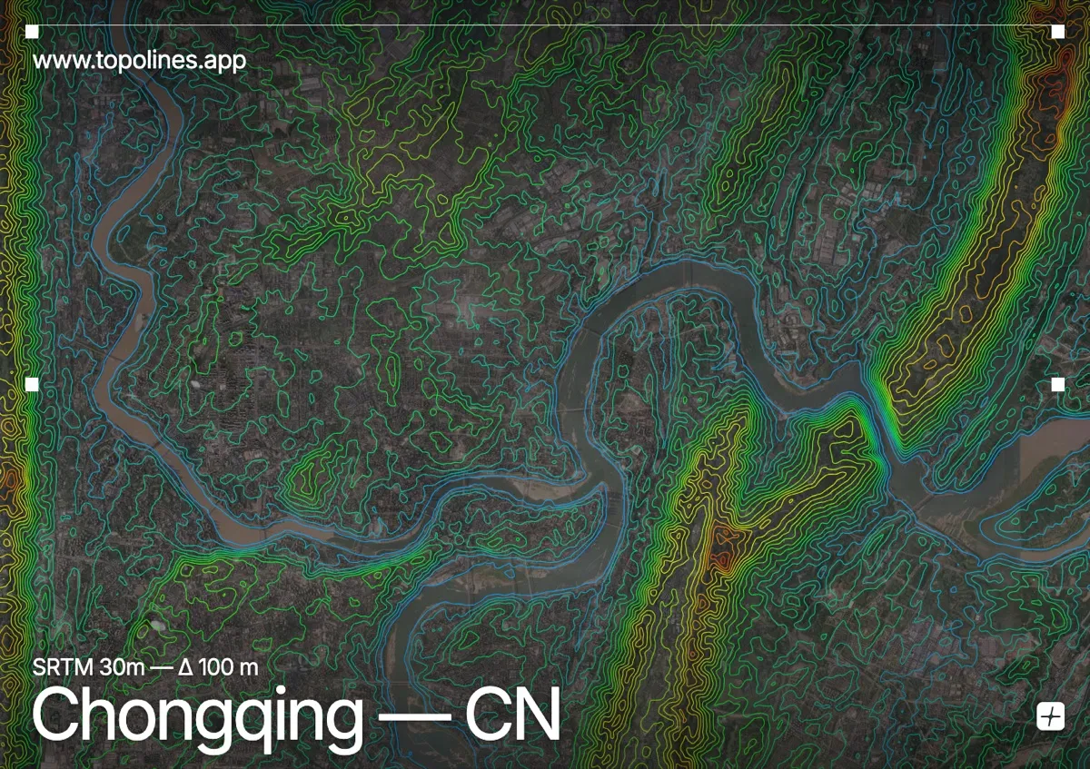
Chongqing is China's great mountain city, built across steep hills at the confluence of the Yangtze and Jialing rivers. Its core sits on a rocky peninsula between the two rivers, so densely stacked that roads, monorails and buildings pile over one another up the slopes.
Parallel ridges — the Zhongliang and Nan mountains among them — run northeast to southwest across the region, rising toward 1,000 m, while the two rivers cut deep between them and meet at the old city's tip. On the map the confluence reads as a Y of open water splitting a terrain of long, tightly contoured ridges and the steep peninsula wedged between the rivers.
How this map was made
Every contour line traces a constant elevation drawn from the public GEDTM30 30 m bare-earth terrain model, extracted with a marching-squares algorithm at a 100 m interval and coloured by height — cool blues in the valley climbing to warm reds on the summits. The satellite base layer and the contours share the same Web Mercator projection, so the lines fall exactly on the ground they describe.
You can regenerate this exact view — and change the interval, colours, resolution or export it as a print-ready SVG — directly in the TopoLines editor.