Topographic map
of Caracas
Cordillera de la Costa, Venezuela — 100 m contours over bare-earth elevation data.
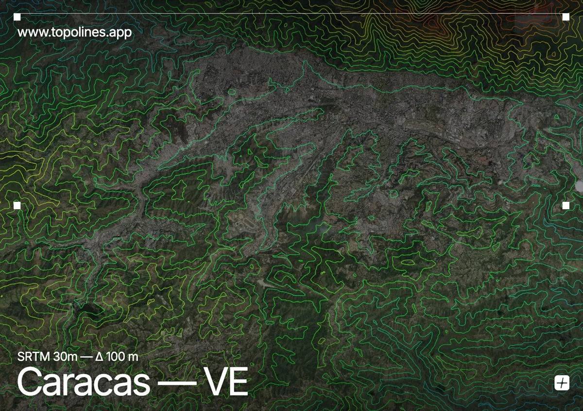
Caracas fills a long, narrow valley at around 900 m, separated from the Caribbean by the sheer green wall of El Ávila. The mountain rises straight from the city's northern edge to 2,700 m, cutting the capital off from a coast that lies only a few kilometres away.
El Ávila — Waraira Repano — walls the north with a continuous, densely contoured front topping out at Pico Naiguatá near 2,765 m, while the Cordillera de la Costa closes the south more gently. The Guaire river threads the valley floor. On the map the northern range reads as one of the sharpest mountain fronts of any capital, hemming the elongated built valley against its base.
How this map was made
Every contour line traces a constant elevation drawn from the public GEDTM30 30 m bare-earth terrain model, extracted with a marching-squares algorithm at a 100 m interval and coloured by height — cool blues in the valley climbing to warm reds on the summits. The satellite base layer and the contours share the same Web Mercator projection, so the lines fall exactly on the ground they describe.
You can regenerate this exact view — and change the interval, colours, resolution or export it as a print-ready SVG — directly in the TopoLines editor.