Topographic map
of Bogotá
Cundinamarca, Colombia — 100 m contours over bare-earth elevation data.
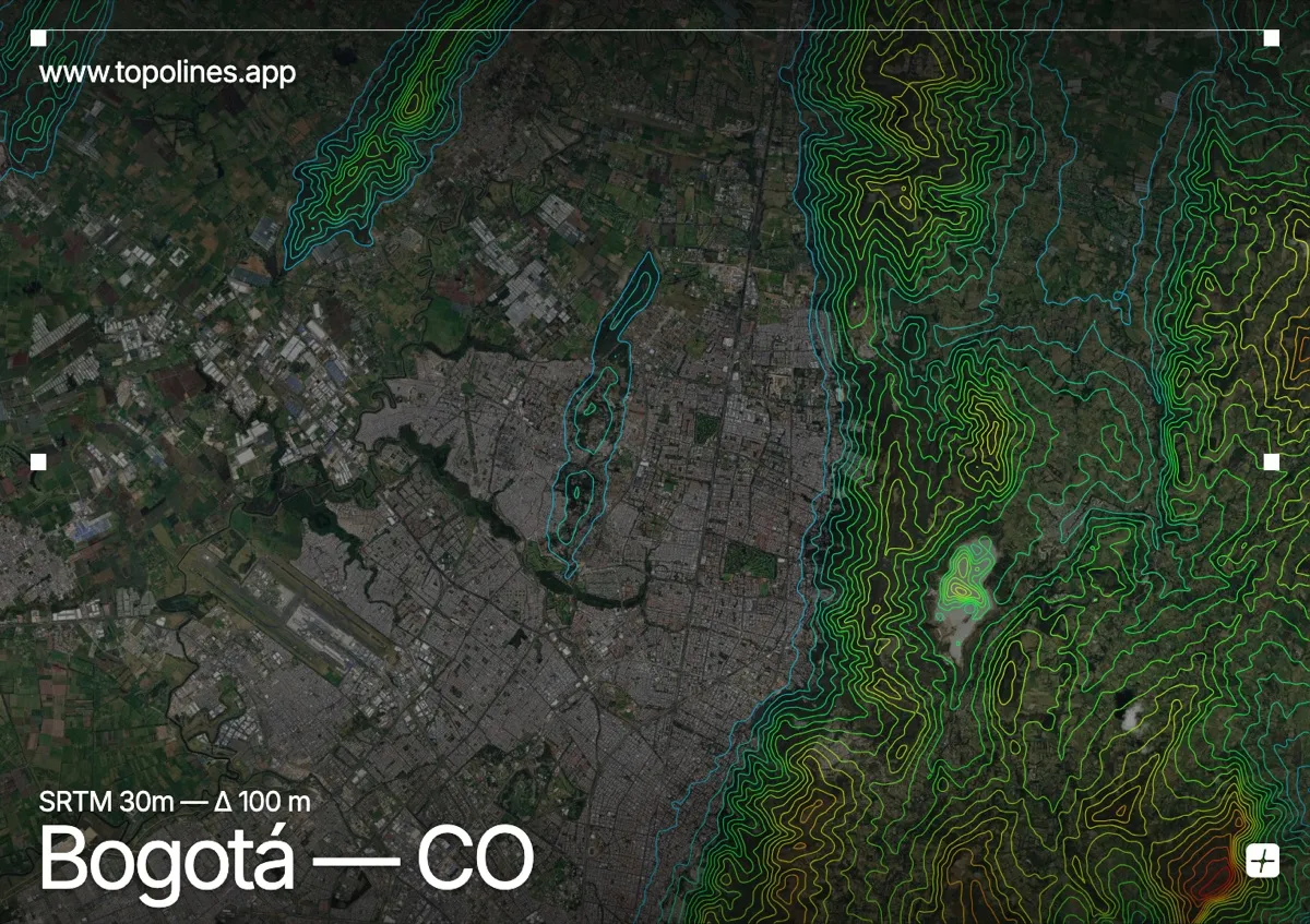
Bogotá sits on a high Andean plateau at 2,640 m, pressed against the Cerros Orientales — the eastern hills that rise like a green wall directly behind the historic centre. The savanna spreads flat to the west while the mountains close the city sharply to the east.
Monserrate and Guadalupe crown the ridge immediately above La Candelaria, climbing past 3,150 m within a couple of kilometres of the streets, and the Cerros Orientales continue as a continuous front toward 3,600 m. West of the city the Sabana de Bogotá runs almost dead flat. On the map the split is stark: an open, gently contoured plateau abruptly bounded by the dense band of the eastern hills.
How this map was made
Every contour line traces a constant elevation drawn from the public GEDTM30 30 m bare-earth terrain model, extracted with a marching-squares algorithm at a 100 m interval and coloured by height — cool blues in the valley climbing to warm reds on the summits. The satellite base layer and the contours share the same Web Mercator projection, so the lines fall exactly on the ground they describe.
You can regenerate this exact view — and change the interval, colours, resolution or export it as a print-ready SVG — directly in the TopoLines editor.