Topographic map
of Bern
Bernese Mittelland, Switzerland — 50 m contours over bare-earth elevation data.
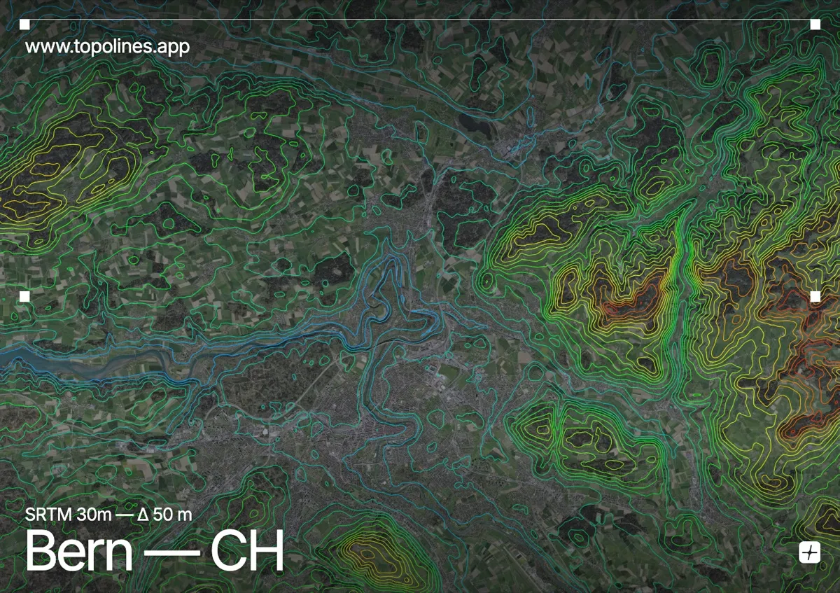
Bern's medieval old town sits on a high sandstone peninsula wrapped almost entirely by a tight loop of the Aare river, some 30 m below. The city grew on this defensible spur, and the river's deep meander is the defining feature of its site.
The Aare carves a steep-sided loop around the old town, isolating it on three sides, while the wooded hills of the Gurten (858 m) and Bantiger (947 m) rise just beyond the built area. The Bernese Mittelland rolls gently between them, with the high Alps visible far to the south. On the map the river's incised loop reads as a sharp, curling channel cut into an otherwise softly contoured plateau.
How this map was made
Every contour line traces a constant elevation drawn from the public GEDTM30 30 m bare-earth terrain model, extracted with a marching-squares algorithm at a 50 m interval and coloured by height — cool blues in the valley climbing to warm reds on the summits. The satellite base layer and the contours share the same Web Mercator projection, so the lines fall exactly on the ground they describe.
You can regenerate this exact view — and change the interval, colours, resolution or export it as a print-ready SVG — directly in the TopoLines editor.