Topographic map
of Bergen
Vestland, Norway — 40 m contours over bare-earth elevation data.
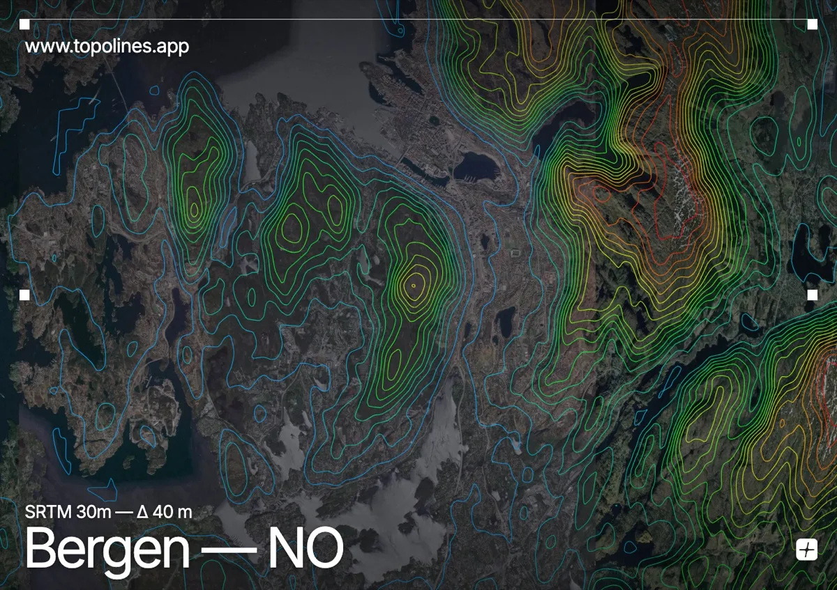
Bergen is built into a bowl among the seven mountains, its harbour and streets threading between steep forested hills and the fjords. The city is famously hemmed in, and a contour map shows exactly how little flat ground it has.
Fløyen and Ulriken rise straight from the centre to around 320 and 640 m, with Løvstakken and the other peaks closing the ring. Sea inlets and fjords cut deep between the slopes, so the contours alternate between tight climbs and the clean lines of the coastline. It is a compact, intricate relief that reads beautifully at this scale.
How this map was made
Every contour line traces a constant elevation drawn from the public GEDTM30 30 m bare-earth terrain model, extracted with a marching-squares algorithm at a 40 m interval and coloured by height — cool blues in the valley climbing to warm reds on the summits. The satellite base layer and the contours share the same Web Mercator projection, so the lines fall exactly on the ground they describe.
You can regenerate this exact view — and change the interval, colours, resolution or export it as a print-ready SVG — directly in the TopoLines editor.