Topographic Map of Malcesine
Veneto, Italy · 45.7685° N · 10.8315° E
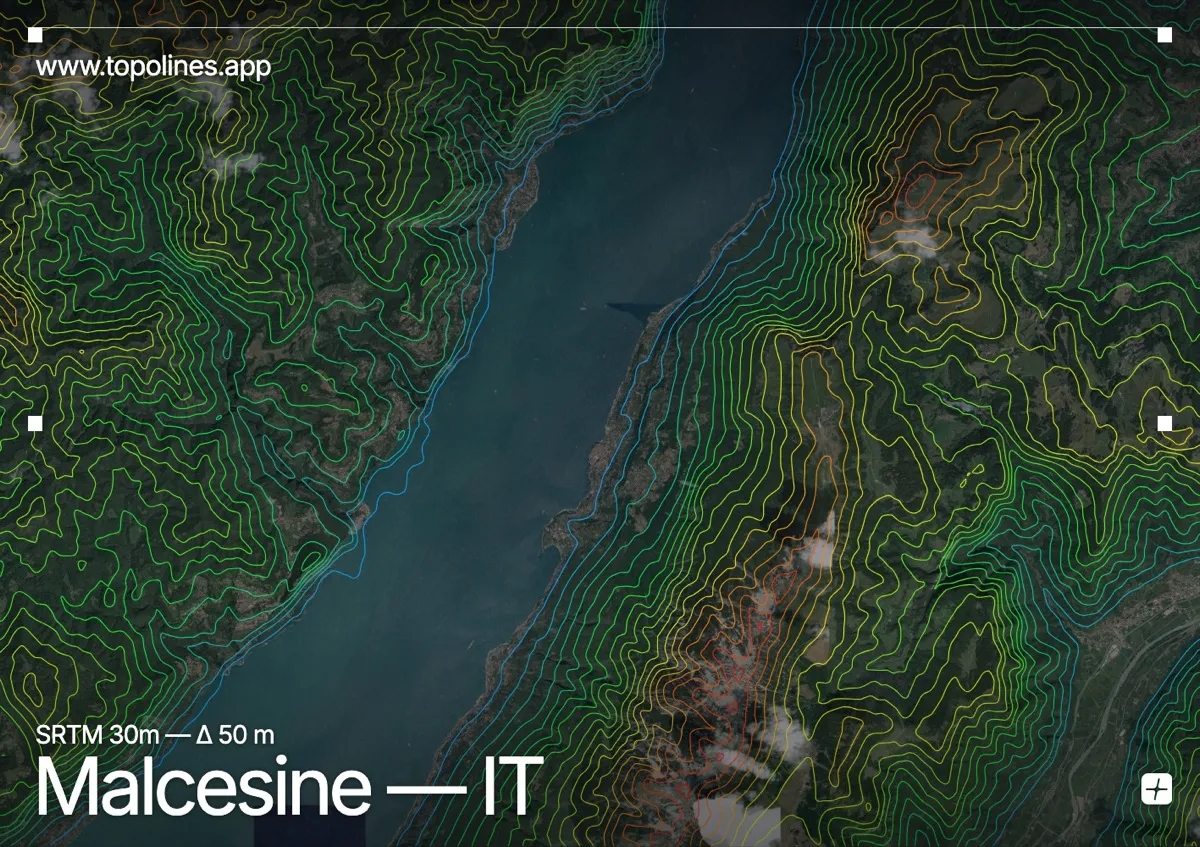
Malcesine sits on the eastern shore of Lake Garda, where the water meets the steep limestone slopes of Monte Baldo. The town occupies a narrow coastal strip that quickly gives way to sharply rising terrain, creating a striking contrast between the flat lake surface and the tightly packed contour lines of the mountain front. This dramatic relief makes the area a clear study in how alpine foothills descend directly into a major glacial lake.
The terrain around Malcesine
The settlement rests along a narrow lakeside plain that opens toward the southwest, backed immediately by the steep, forested escarpment of Monte Baldo. Contour lines pack tightly together as they climb the limestone ridges, reflecting the rapid elevation gain that characterizes this eastern Alpine foothill zone. Winding roads and historic terraces trace the mid-slopes, where the lines loosen slightly before tightening again near the higher crags and karst plateaus. To the south, the Garda shoreline curves gently around a small harbor, while the northern approaches are flanked by lower rolling Veronese hills that gradually merge into the broader regional landscape. The overall pattern shows a classic lake-mountain transition, with dense spacing along the steepest faces and broad, open intervals across the water and lower terraces.
How this map was made
Every contour line traces a constant elevation drawn from the public GEDTM30 30 m bare-earth terrain model, extracted with a marching-squares algorithm at a 50 m interval and coloured by height — cool blues in the valley climbing to warm reds on the summits. The satellite base layer and the contours share the same Web Mercator projection, so the lines fall exactly on the ground they describe.
You can regenerate this exact view — and change the interval, colours, resolution or export it as a print-ready SVG — directly in the TopoLines editor.