Topographic Map of Dresden
Saxony, Germany · 51.0493° N · 13.7381° E
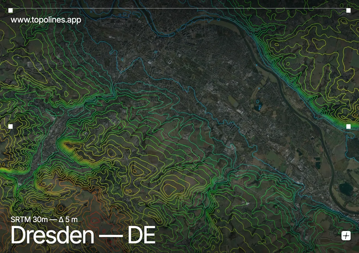
Dresden occupies a broad terrace along the winding Elbe River in eastern Saxony. The surrounding relief transitions quickly from the city’s gentle floodplain into the steep sandstone gorges and plateaus of the Elbe Sandstone Mountains to the southeast. Contour lines here shift from widely spaced bands across the valley floor to tightly packed, intricate loops that trace the eroded rock formations and deep ravines.
The terrain around Dresden
The city rests within the Dresden Basin, where the Elbe carves a broad, meandering corridor through relatively flat terraces. Moving southeast, the terrain rises sharply into the Elbe Sandstone Mountains, where contour lines compress against sheer cliffs and narrow gorges. To the northeast the land rises into the wooded Dresden Heath, its low ridges marked by gentle, widely spaced curves before climbing toward the surrounding hills. To the south, the landscape gradually ascends toward the rolling heights of the Ore Mountains, creating a stepped profile that fans out across the map. Across the frame, the contours alternate between open agricultural flats and dense, interlocking ridges that highlight the region’s complex fluvial history.
How this map was made
Every contour line traces a constant elevation drawn from the public GEDTM30 30 m bare-earth terrain model, extracted with a marching-squares algorithm at a 5 m interval and coloured by height — cool blues in the valley climbing to warm reds on the summits. The satellite base layer and the contours share the same Web Mercator projection, so the lines fall exactly on the ground they describe.
You can regenerate this exact view — and change the interval, colours, resolution or export it as a print-ready SVG — directly in the TopoLines editor.